


1 / 10
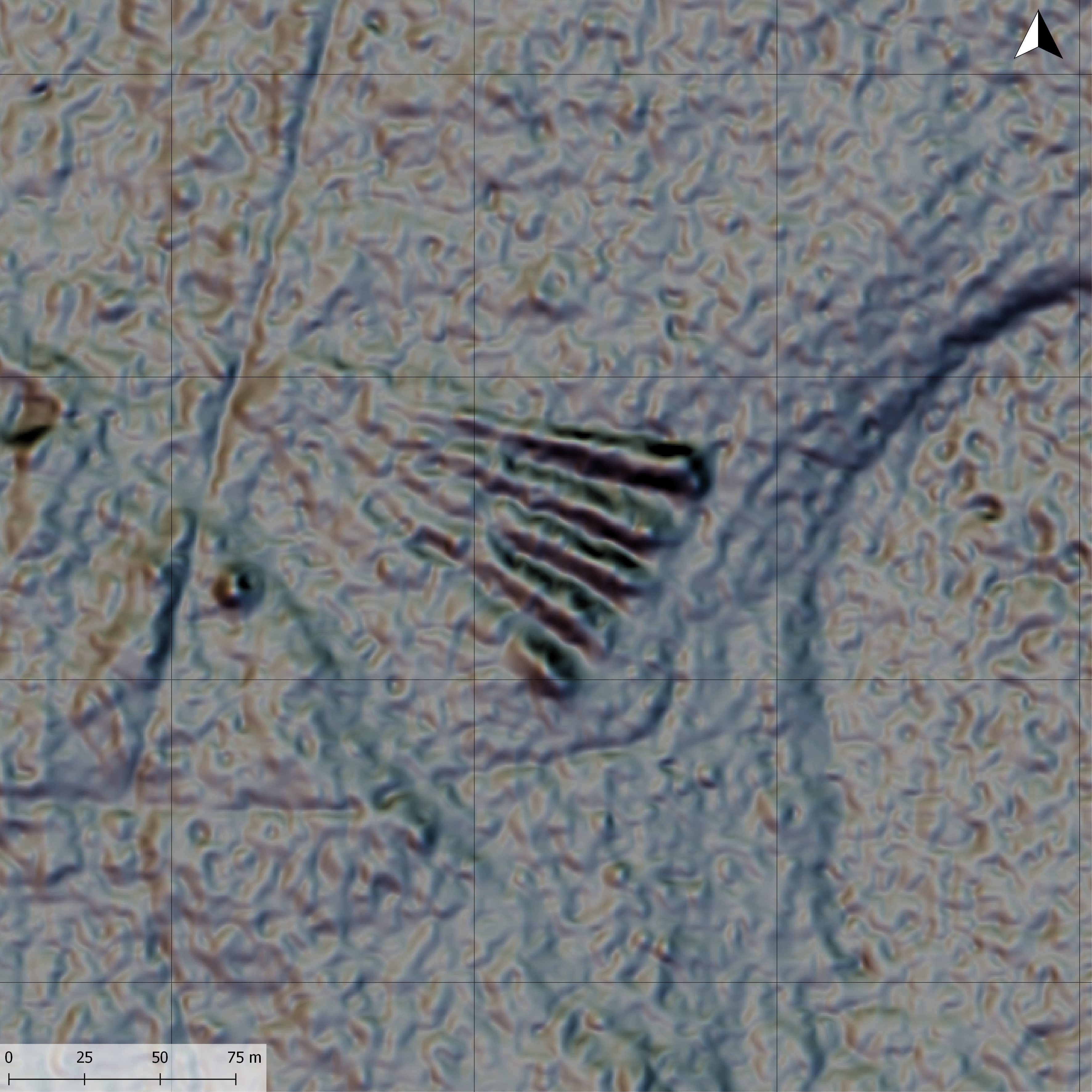
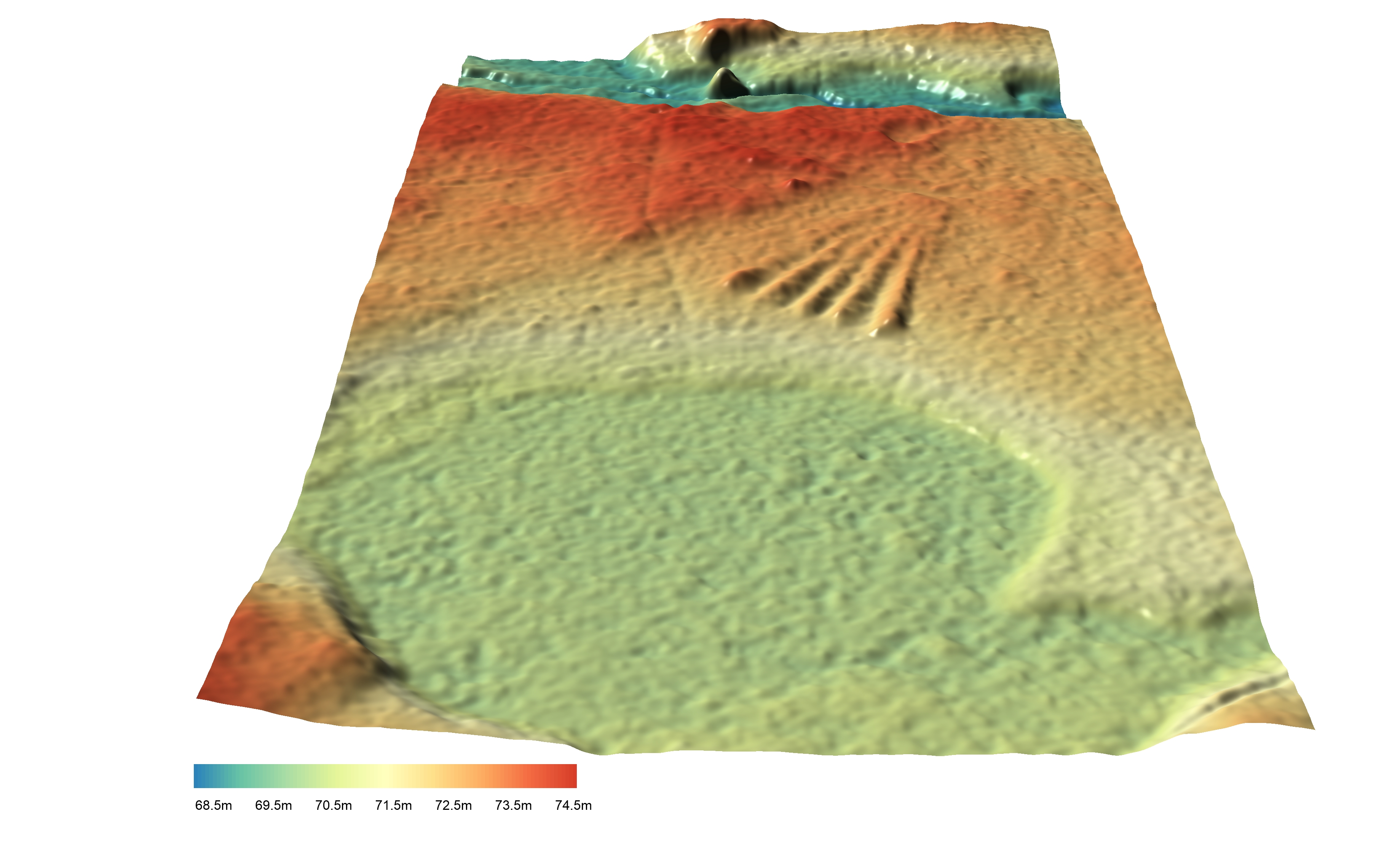
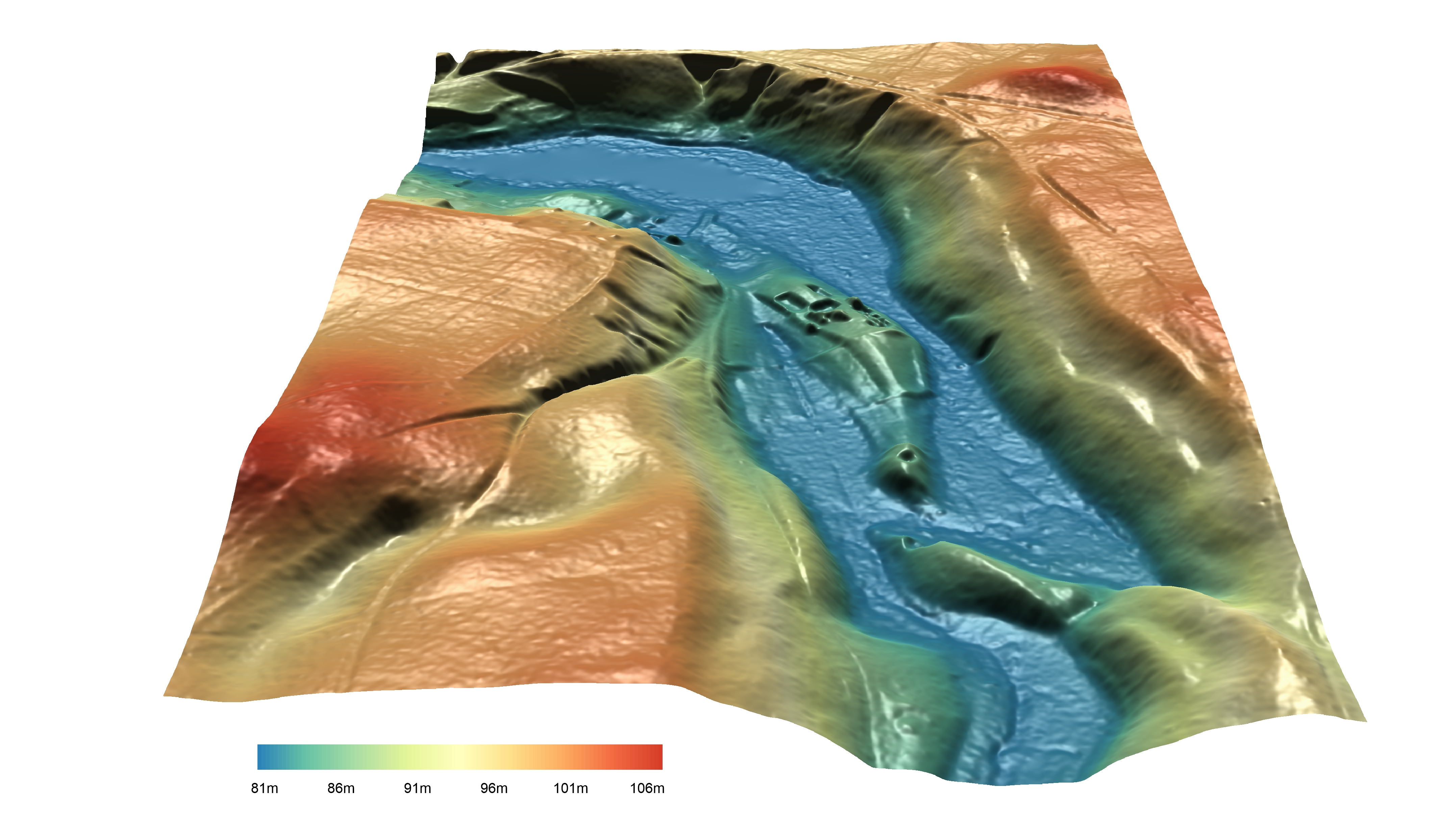
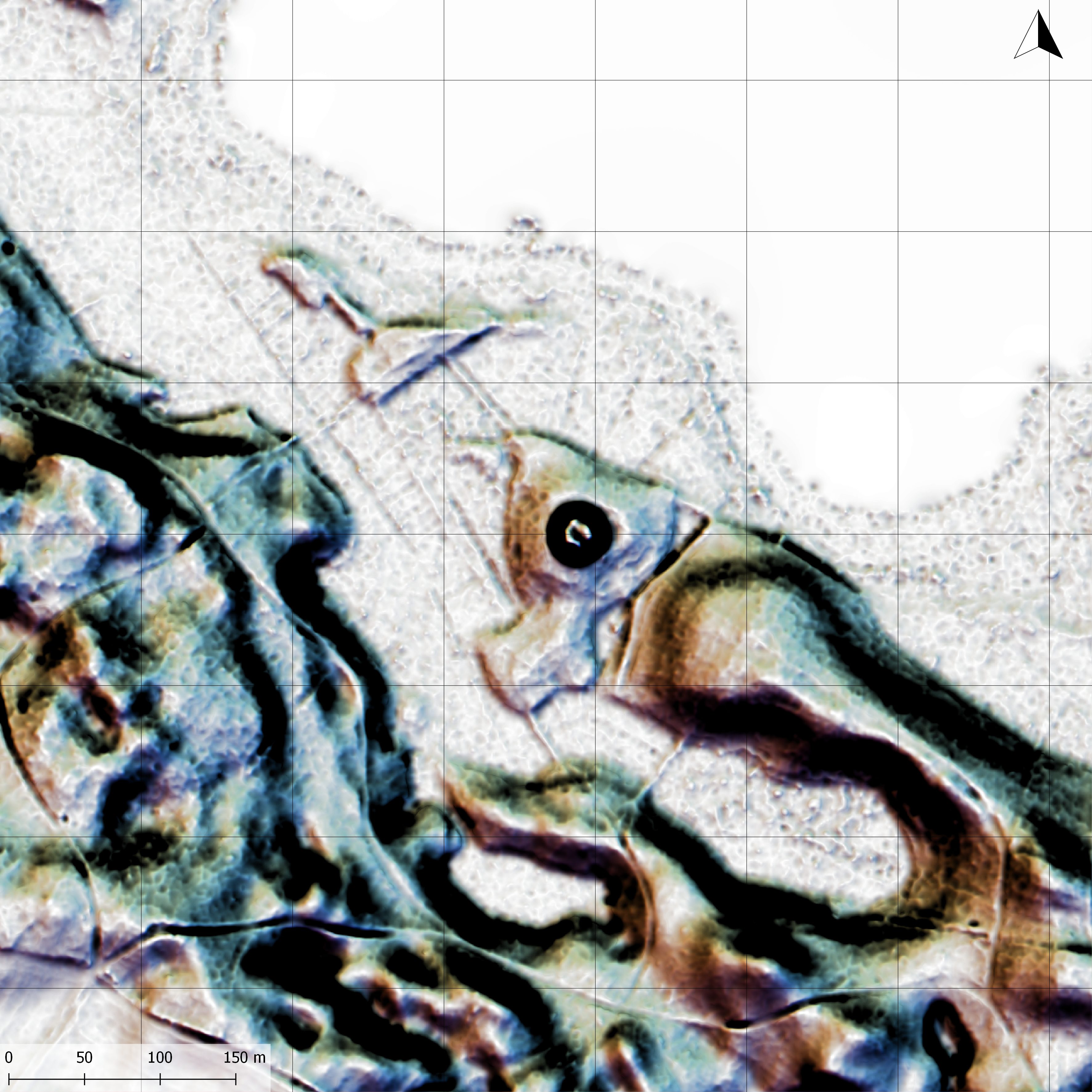
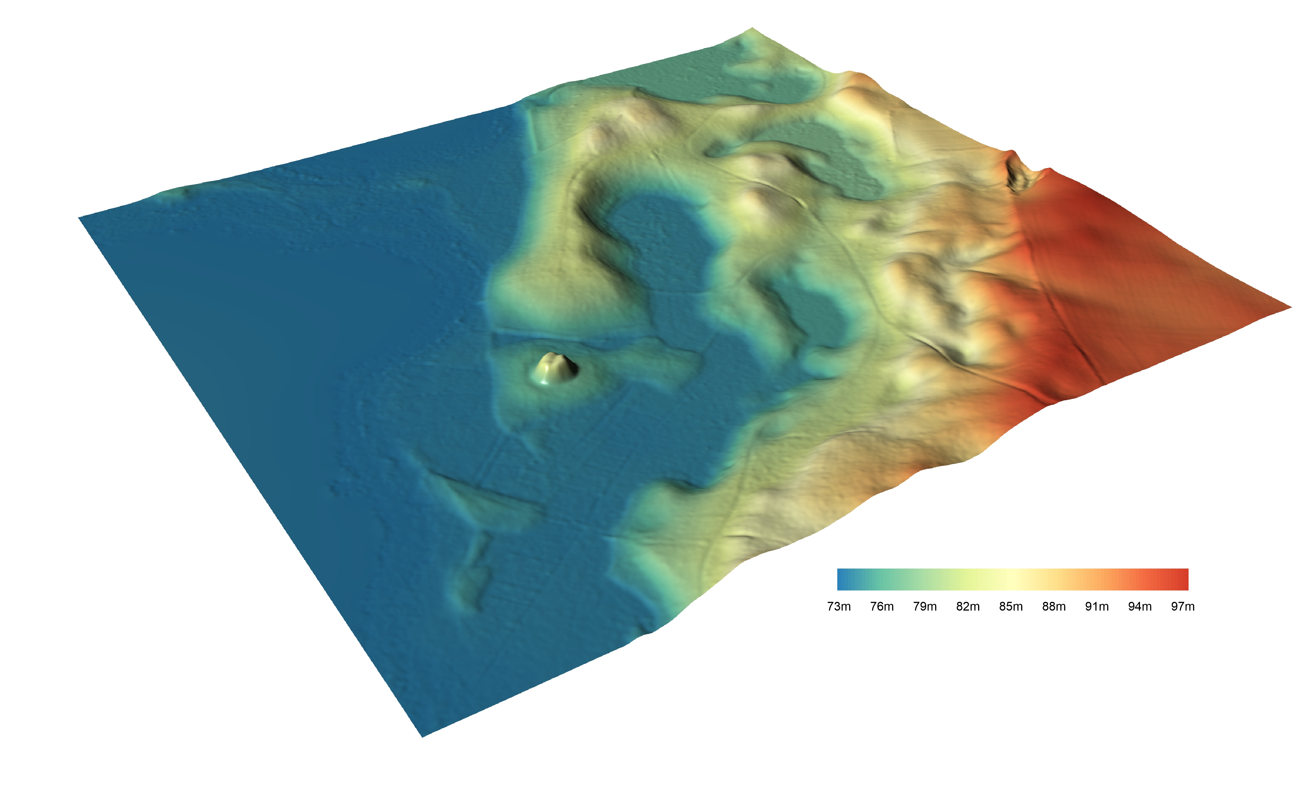
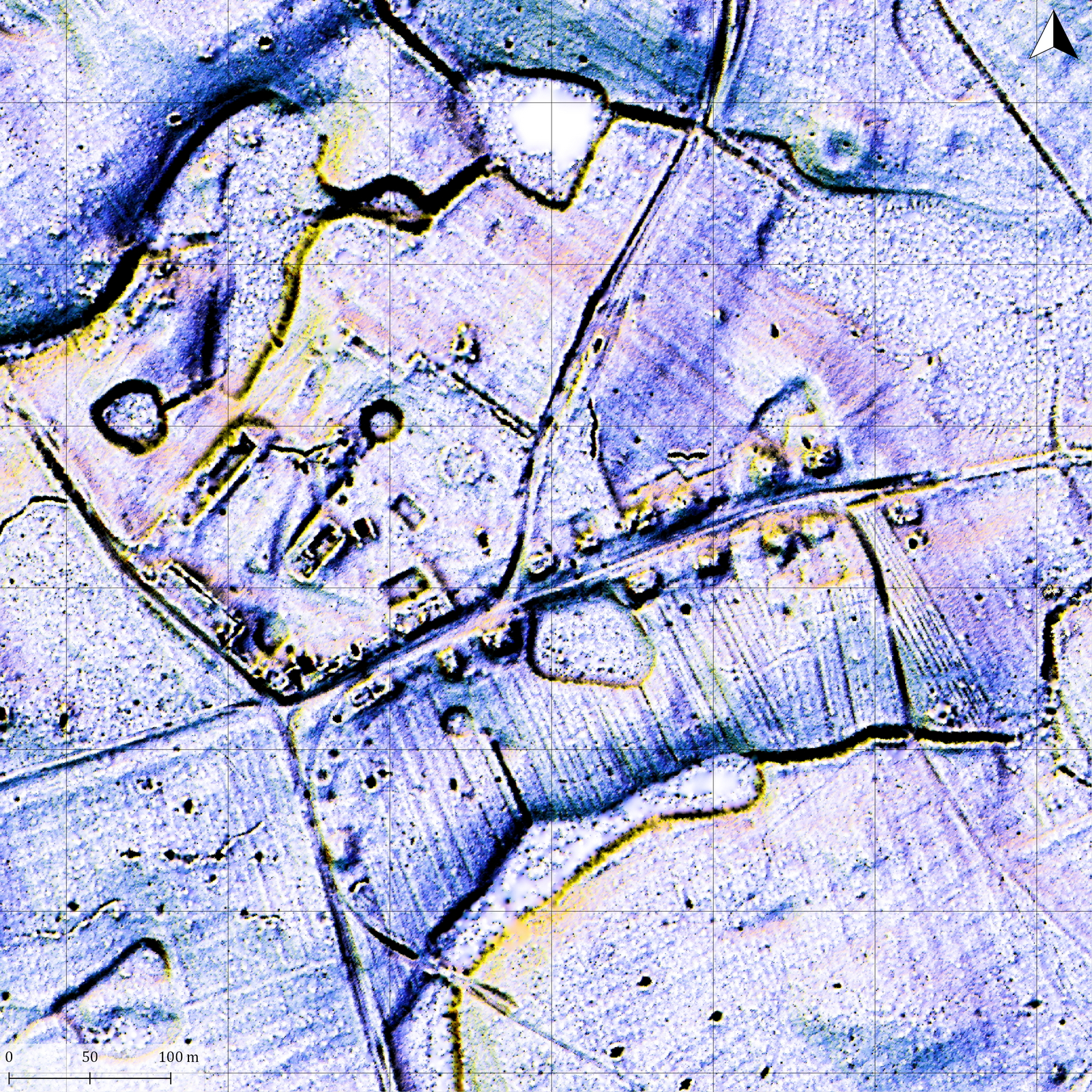
As part of the Forestry Service’s documentation of their archaeological resources we were commissioned with creating various ALS/LiDAR derived visualisations and maps of various features in the Łopuchówko region. This area is quite rich with interesting earthworks showing former trenches, motte-and-baileys, megalithic tombs and deserted villages.