


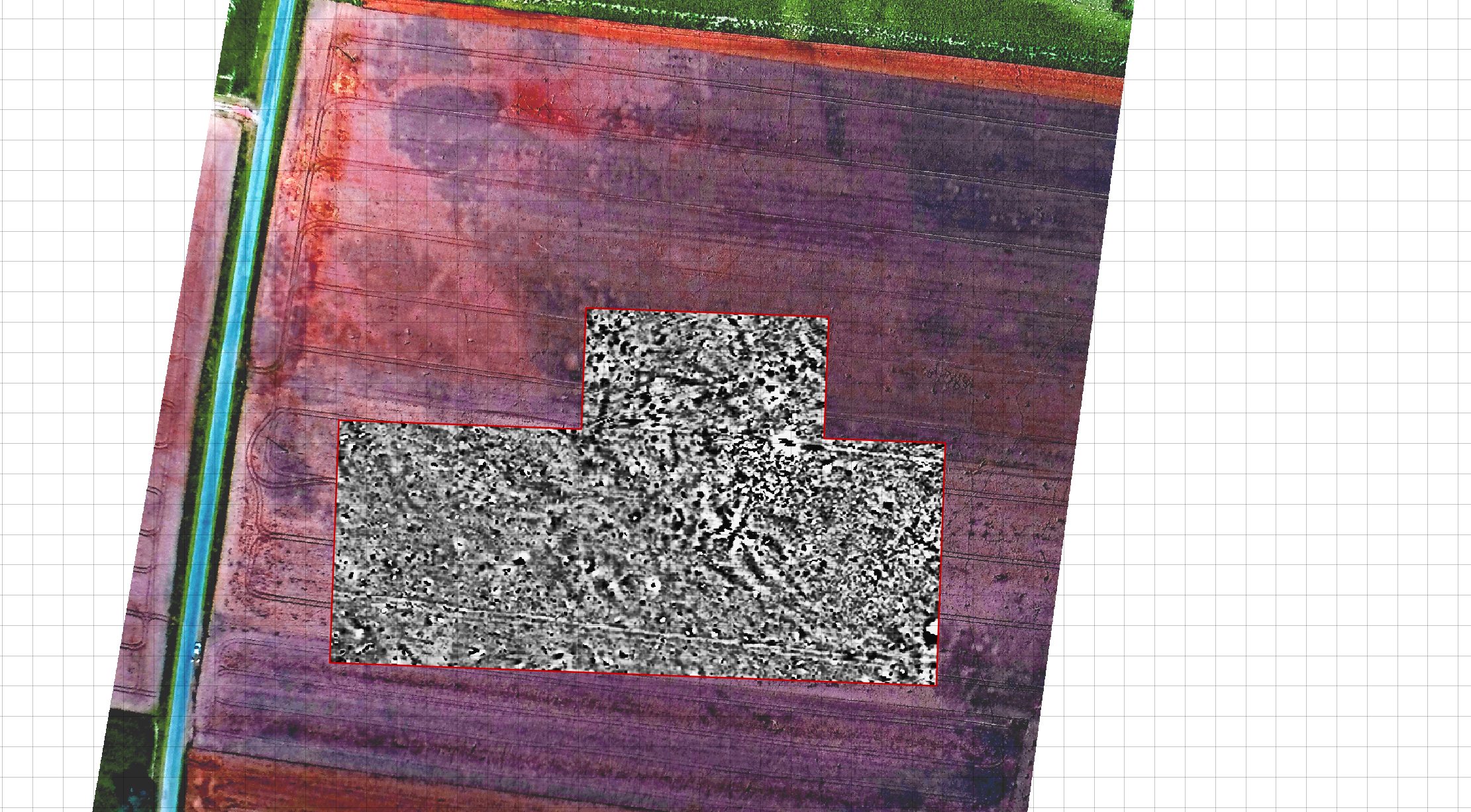
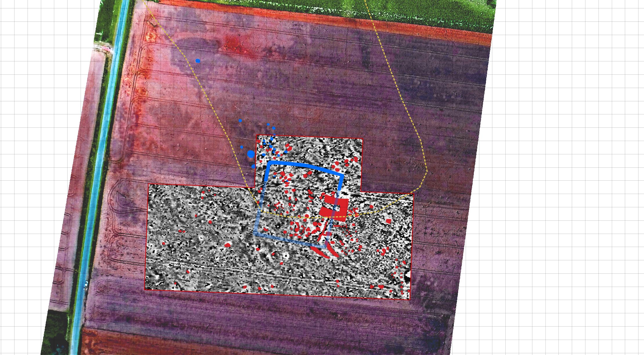
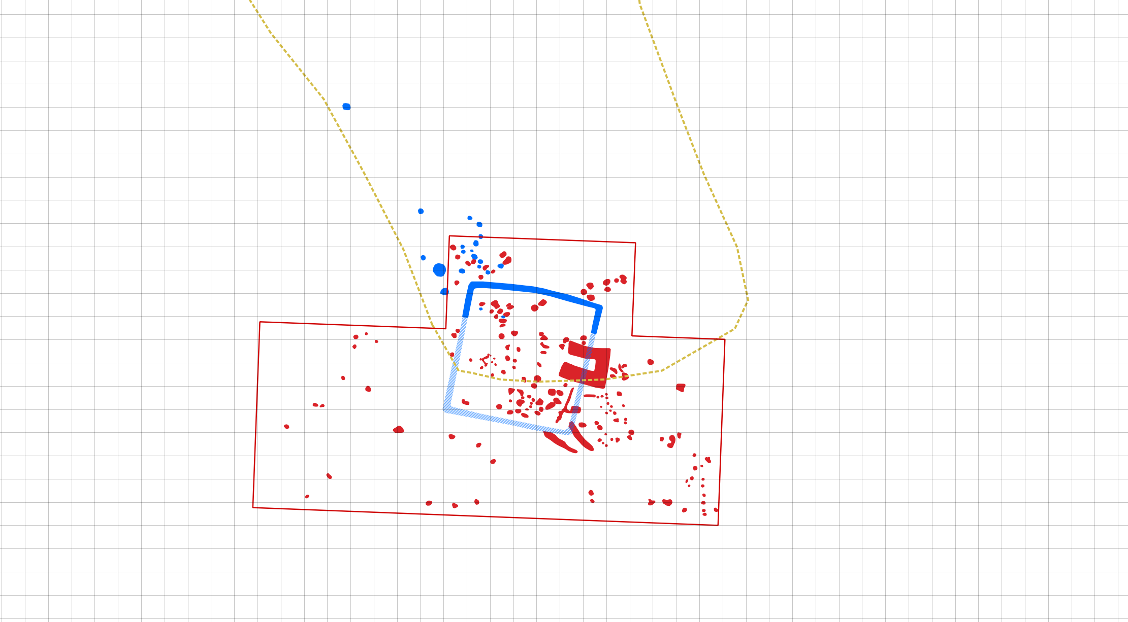
As part of our on-going aerial prospection collaboration with the University of Wrocław we documented an interesting quadrate enclosure. This research shows a simple yet enganging example of data complementarity as various features were visible in two different (magnetic gradiometry & aerial imagery) datasets and through their combination the spatial layout of this previously unknown feature was derived.