
We enjoyed several days in beautiful Öland as part of join Polish-Swedish project. We undertook several test surveys with the use of magnetometry, GPR as well as UAV airborne laser…
Prospection & Digitalisation
We enjoyed several days in beautiful Öland as part of join Polish-Swedish project. We undertook several test surveys with the use of magnetometry, GPR as well as UAV airborne laser…

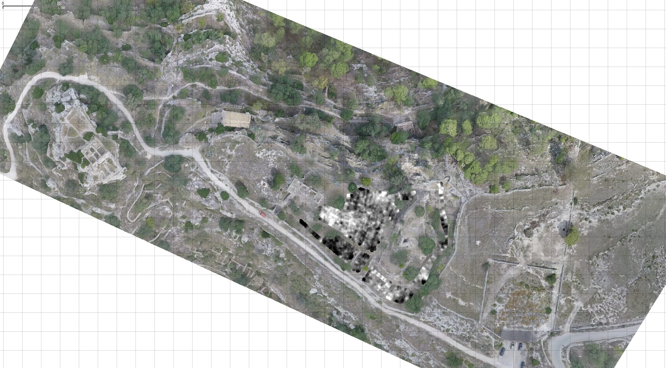
As part of our long term collaboration with the Polish-Italian archaeological project taking place since 2015 in Sicily, we have once more conducted a survey in the town of Scicli.…
This year marked our 10th anniversary in conducting and promoting aerial archaeological prospection in Poland. To this data we have carried out over 250 hours of reconaissance flights countrywide and…
Our co-authored with the University of Wrocław grant application to the Ministry of Culture & National Heritage was accepted and in 2018 and 2019 we were able to conduct and…

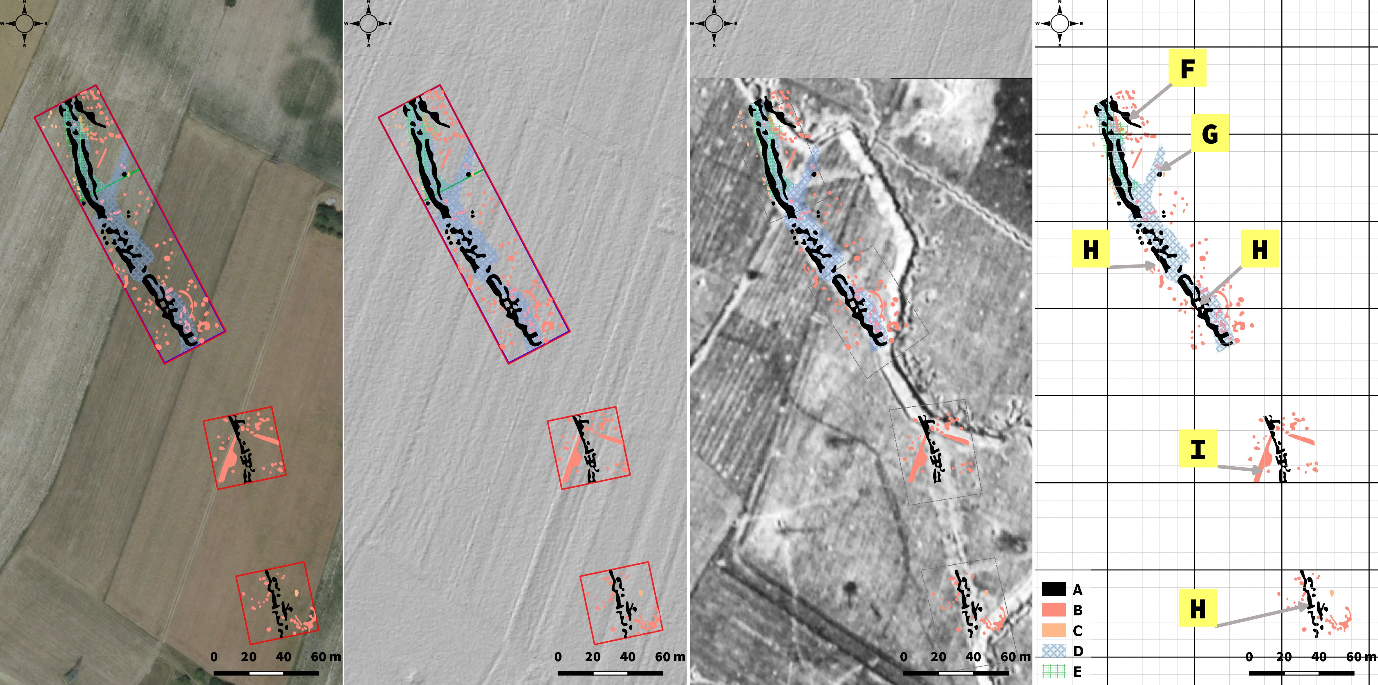
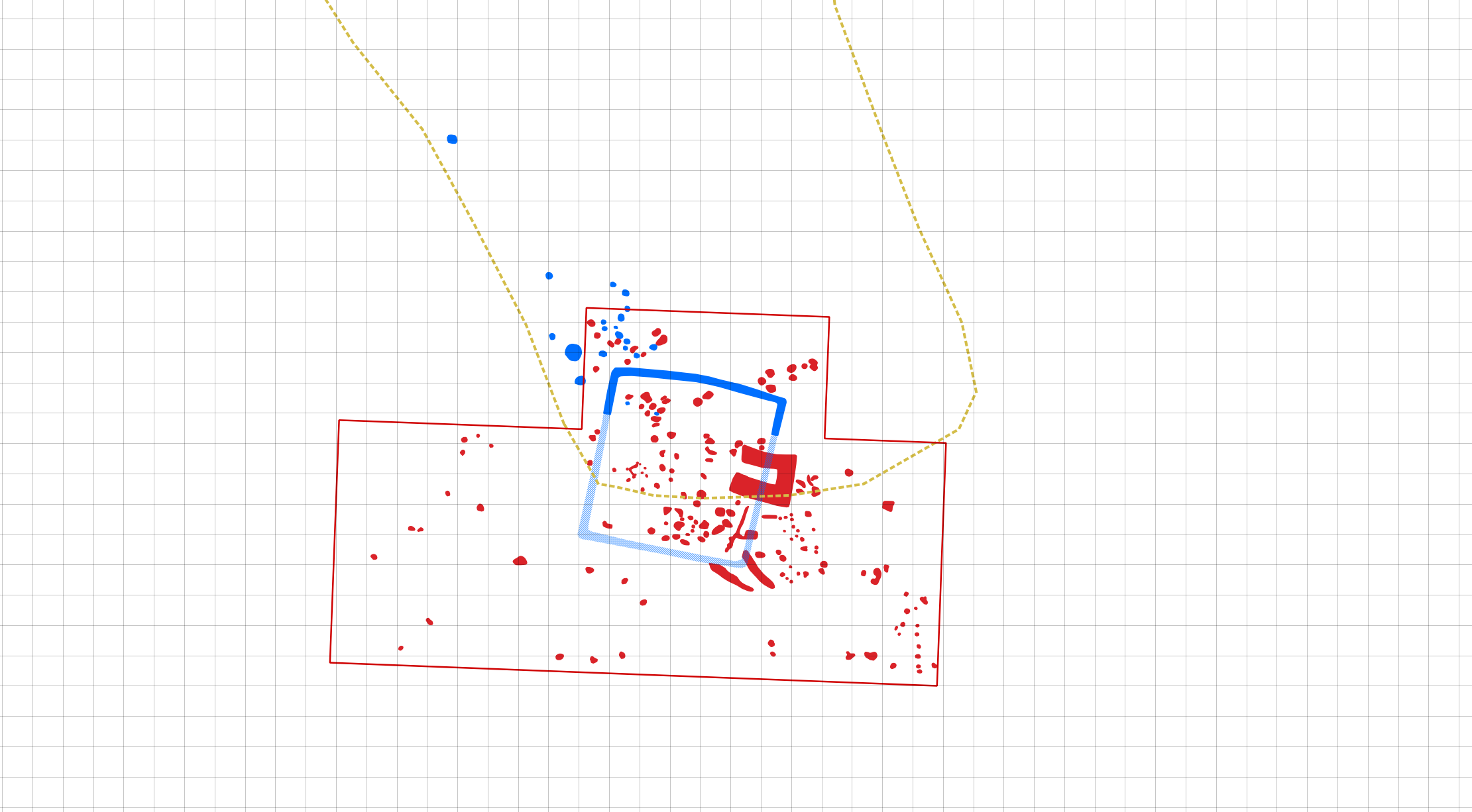
GIS augmented by ALS/LiDAR derivatives and aerial imagery can be very helpful in calibrating and georeferencing archival paper documentation. These usually can be quite schematic and may not possess any…

Archaeologically, the prevailing representation of Przeworsk Culture finds, both in quantity and weight, constitute an important dataset which supplements and confirms both aerial and geophysical interpretations of the Rzemienowice landscape.…

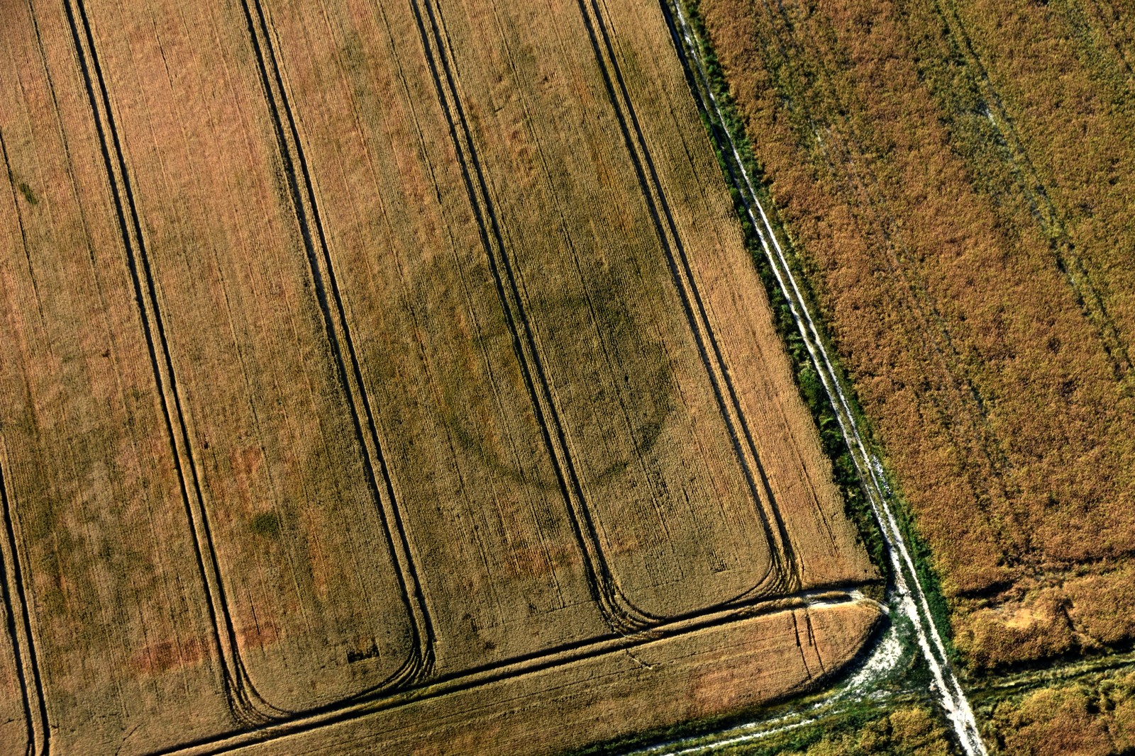
Aerial prospection campaigns carried out for the University of Wrocław brought forth new data towards the existence of a ritual landscape near the village of Drzemlikowice. Crop marks revealed hengiform…
As part of a Polish Academy of Sciences led by prof. Anna Zalewska we investigated selected WW1 sites in Central Poland, including trench complexes and camps. Three geophysical methods were…

The aim of the project is to study the cultural landscapes of prehistoric communities of the Western Lesser Poland Loess Uplands through the application of non-destructive techniques. These include remote…
Non-invasive research conducted by the Centre for Late Antique and Early Medieval Studies of Institute of Archaeology and Ethnology of the Polish Academy of Sciences have been taking place intermittently…
The Scientific Association of Polish Archaeologists, Łódź branch (SNAP Łódź) conducted a research project “From Nieszawa to Dybów – non-invasive prospection of the archaeological landscape between Mała Nieszawka and Dybowski…
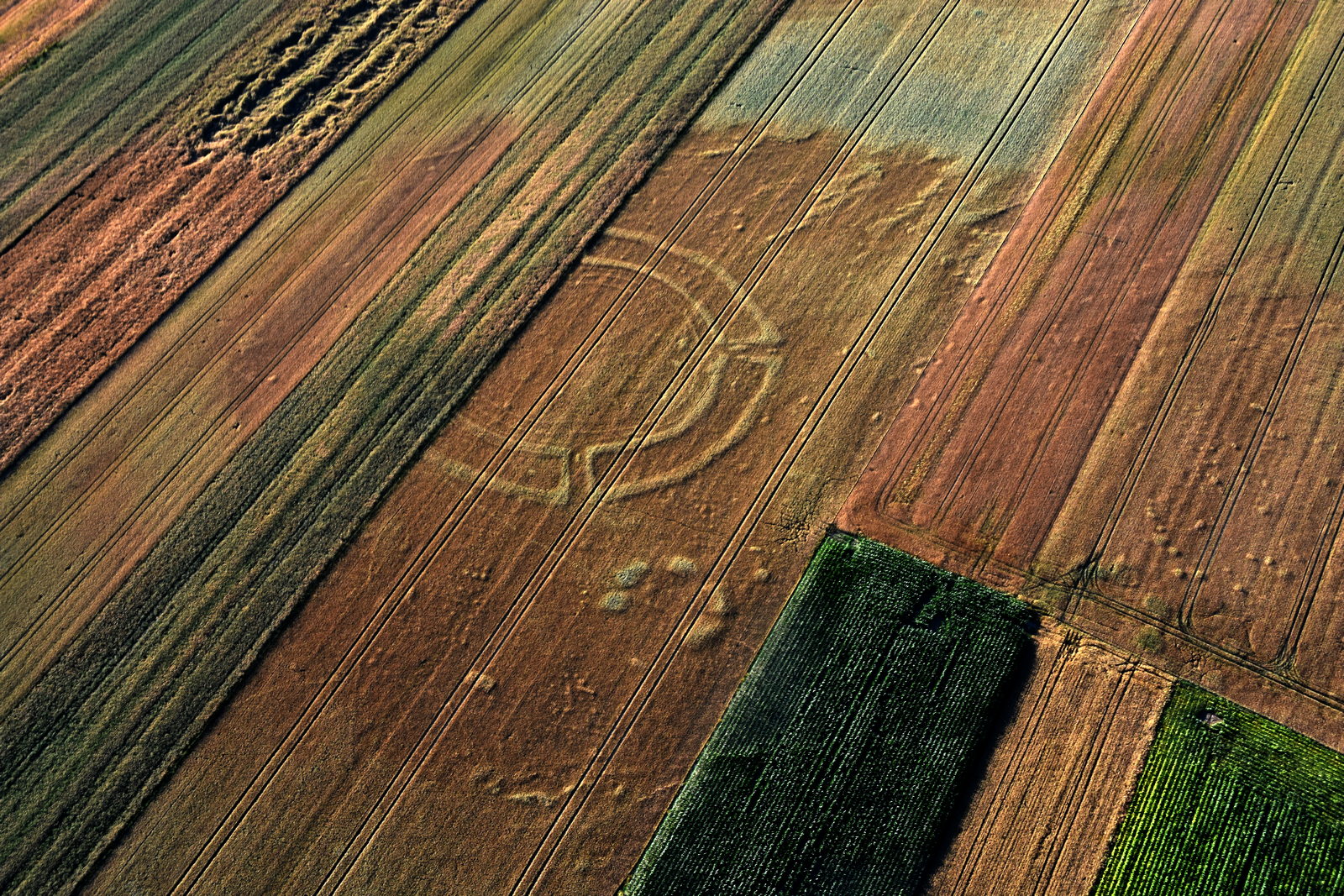
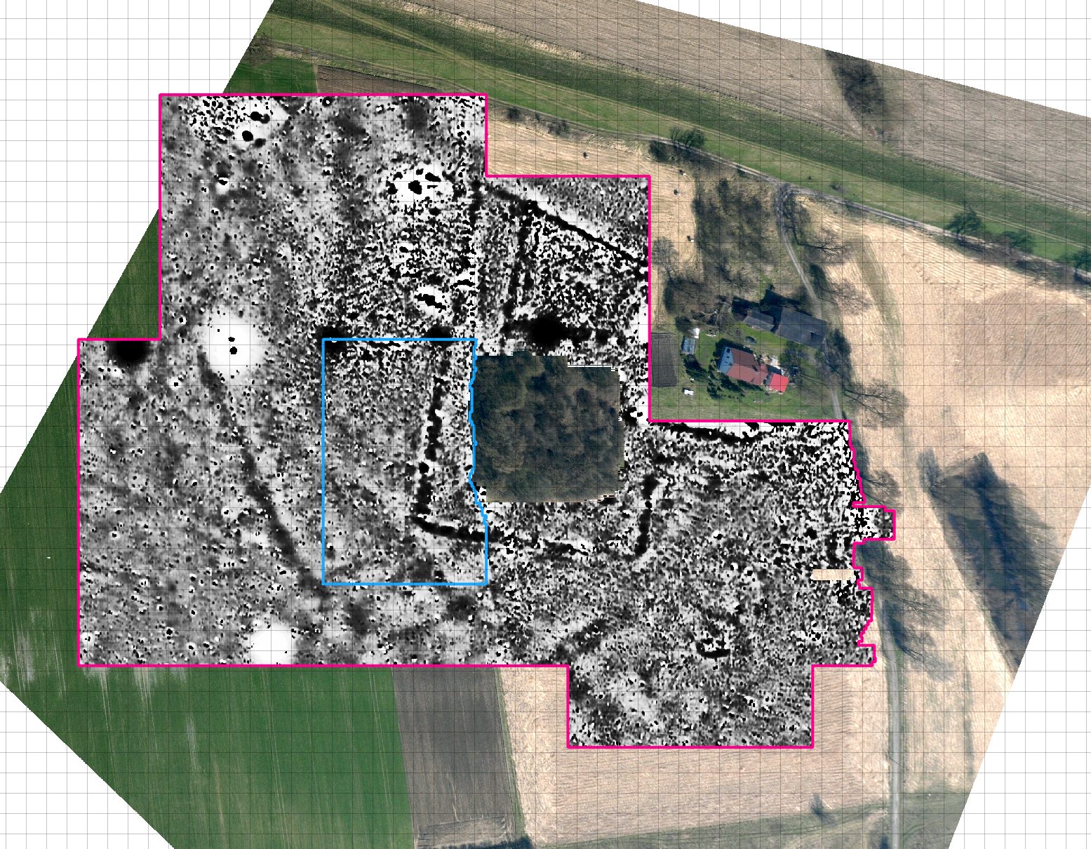
As part of our on-going aerial prospection collaboration with the University of Wrocław we documented an interesting quadrate enclosure. This research shows a simple yet enganging example of data complementarity…