
Discovery of the feature during an aerial prospection mission 
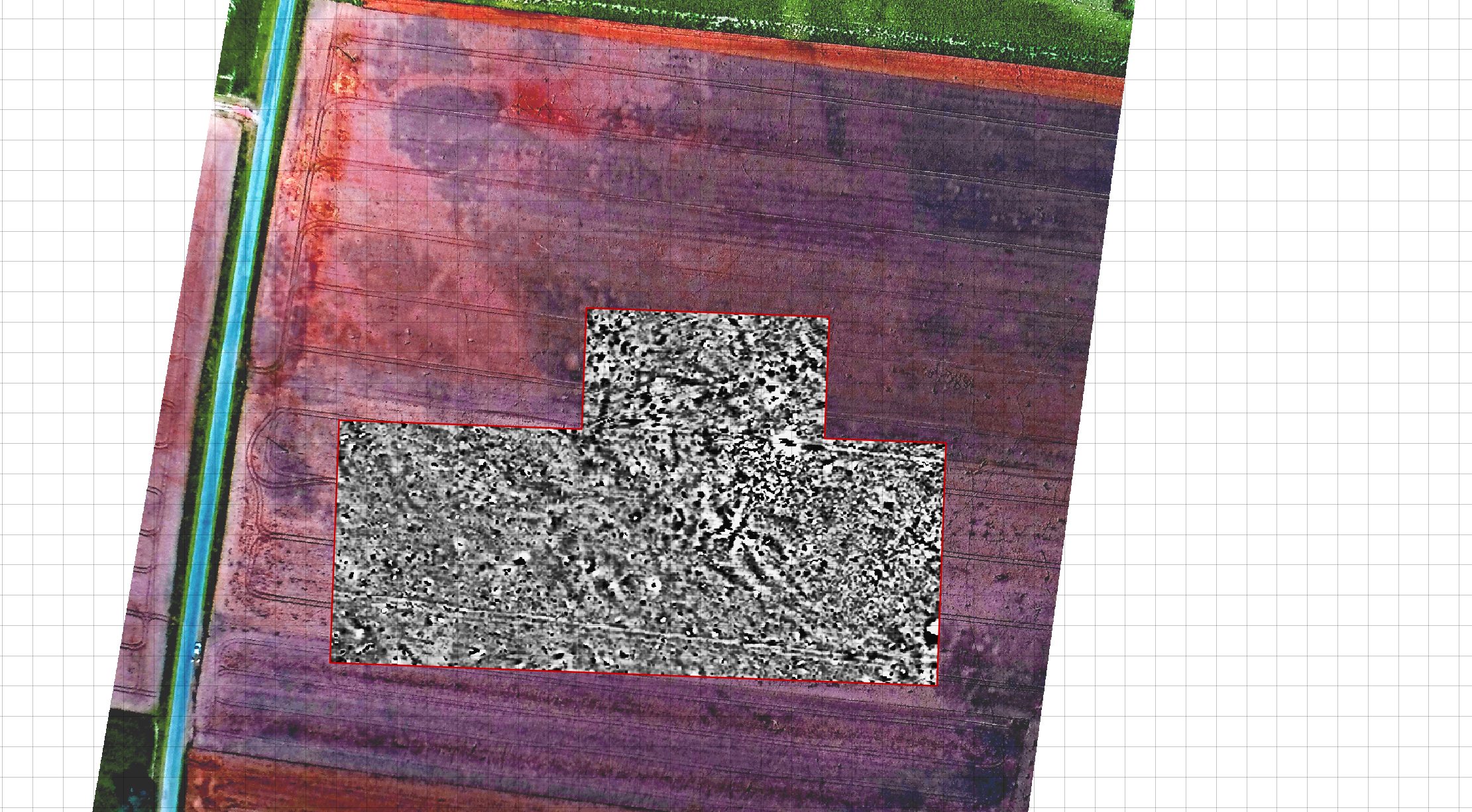
Additional photographic documentation with the use of a UAV system 
Terrestrial work with the application of magnetic gradiometry 
Integrated mapping and interpretation of the site 
Interpretation plot. Red outlines based on geophysical data, blue outlines based on remote sensing data


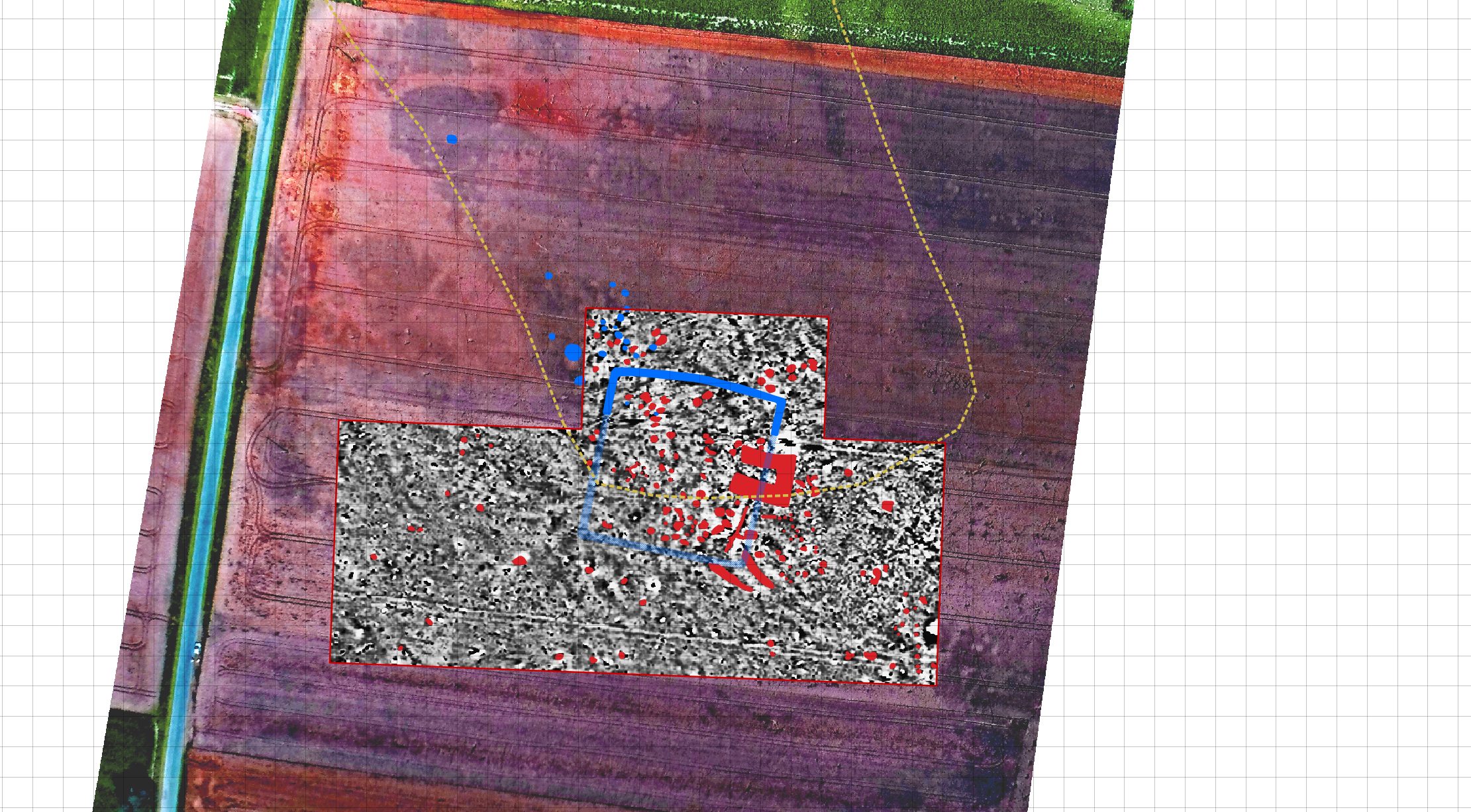
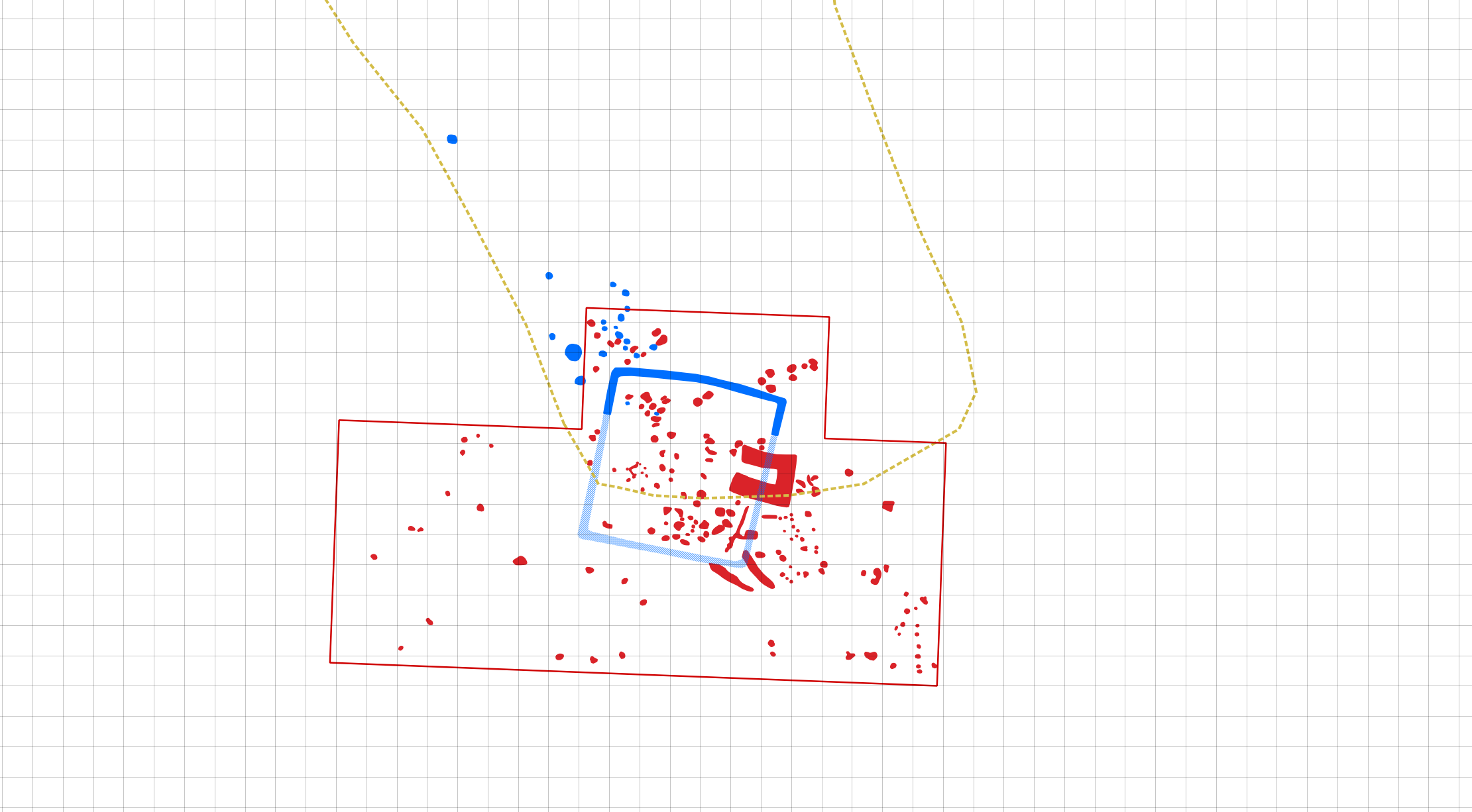
As part of our on-going aerial prospection collaboration with the University of Wrocław we documented an interesting quadrate enclosure. This research shows a simple yet enganging example of data complementarity as various features were visible in two different (magnetic gradiometry & aerial imagery) datasets and through their combination the spatial layout of this previously unknown feature was derived.