
Iron Age site at Rzemienowice 
Multisensor magnetic gradioemtry survey near Bronocice 
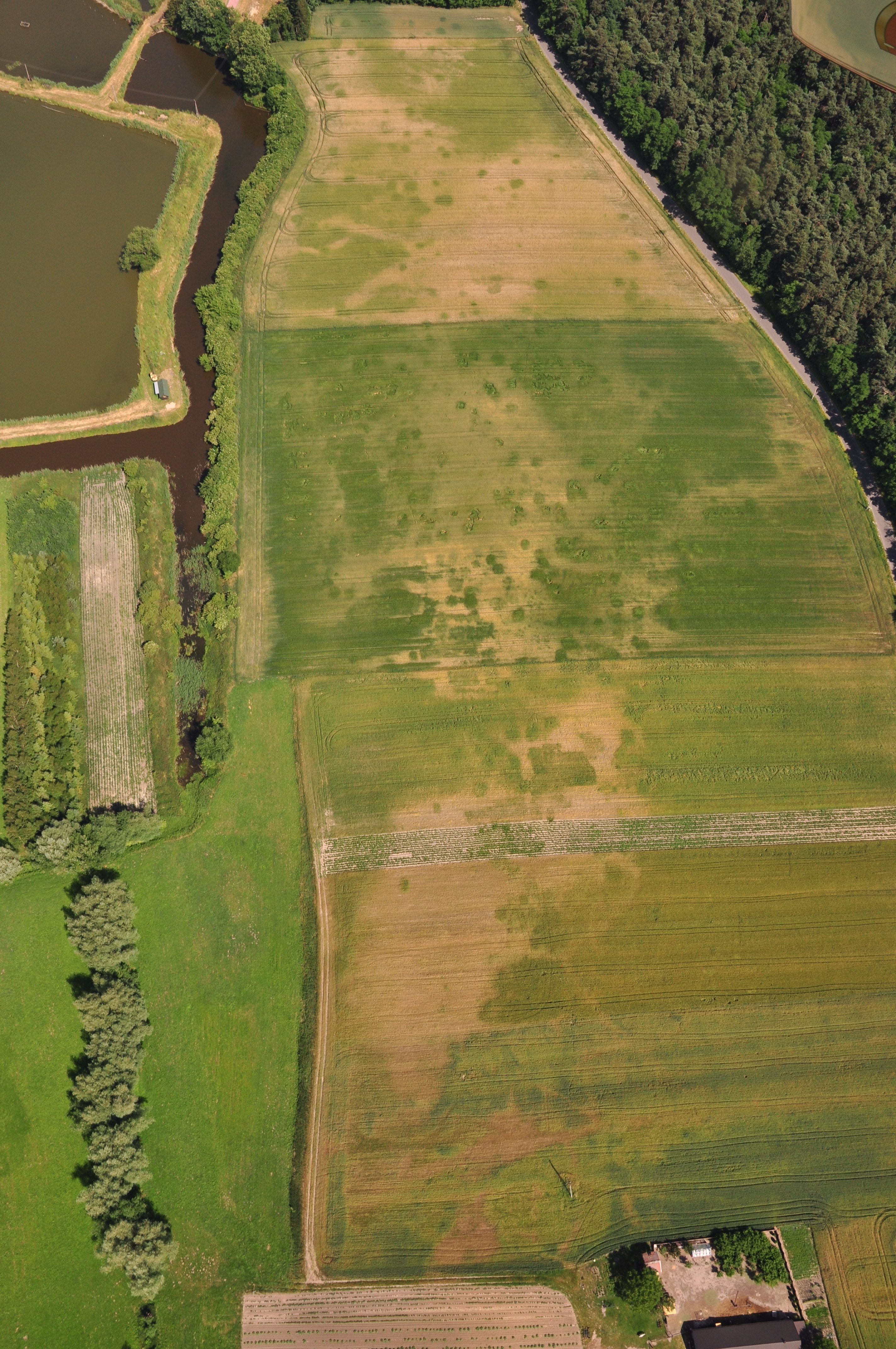
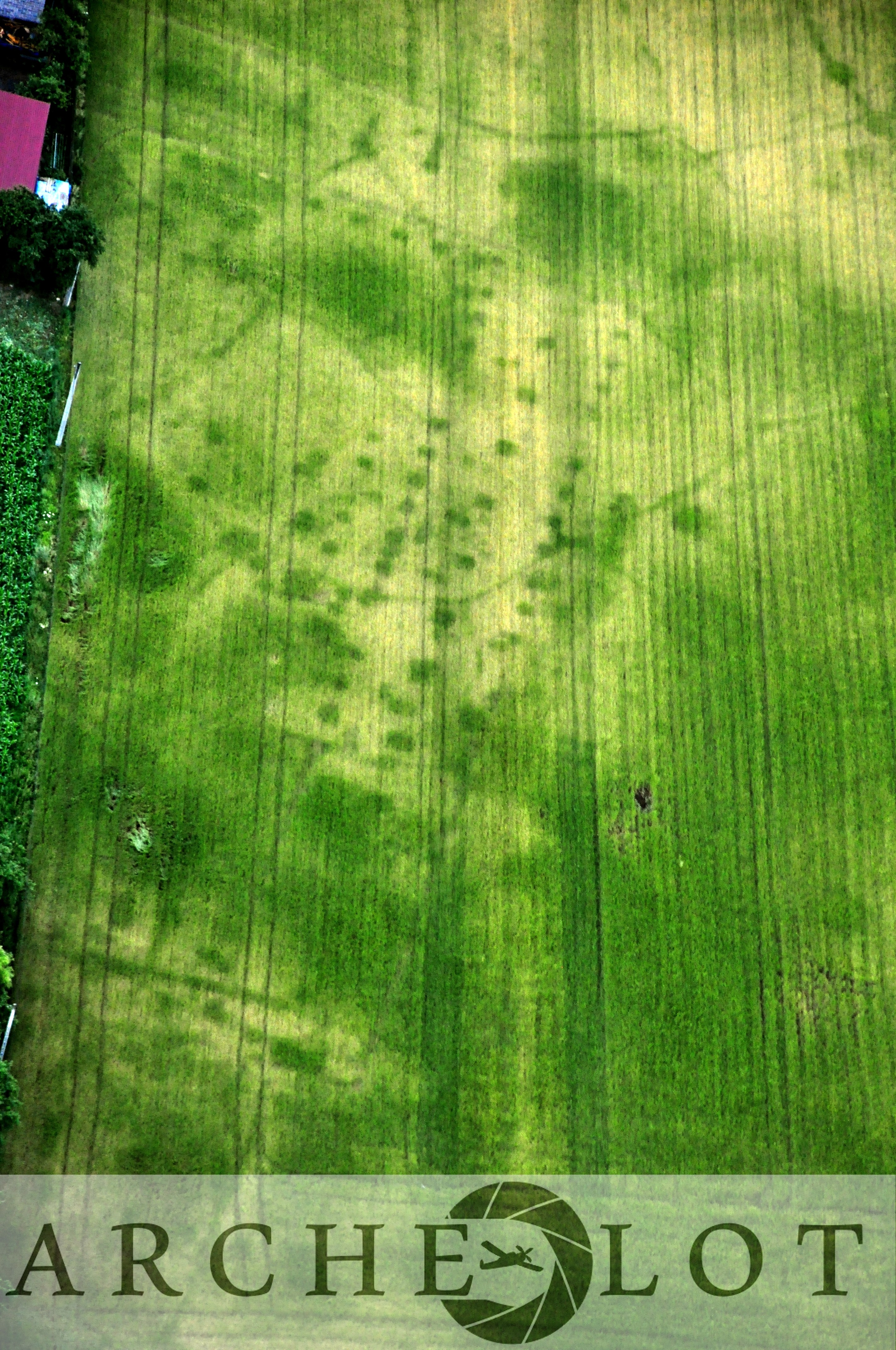
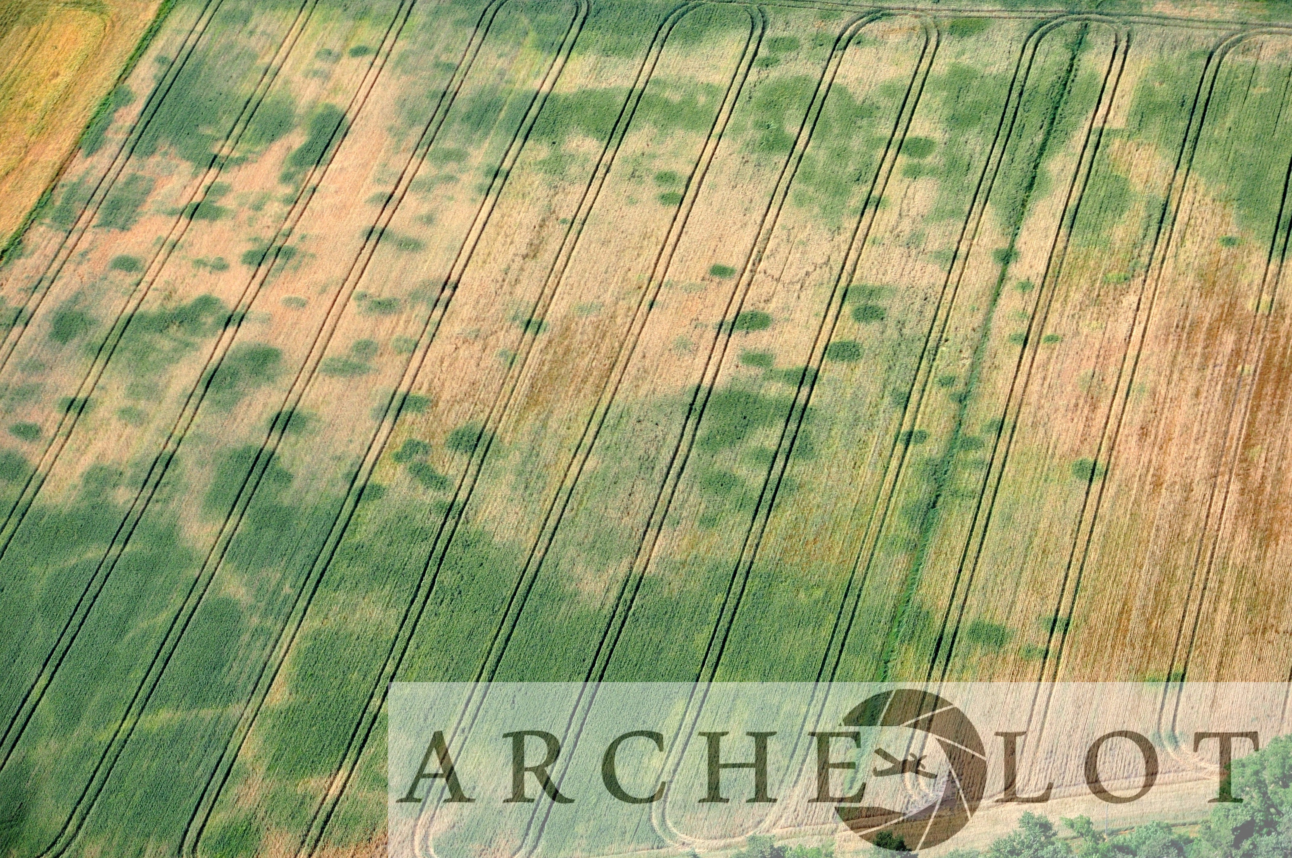
Crop marks show a probable farmstead 
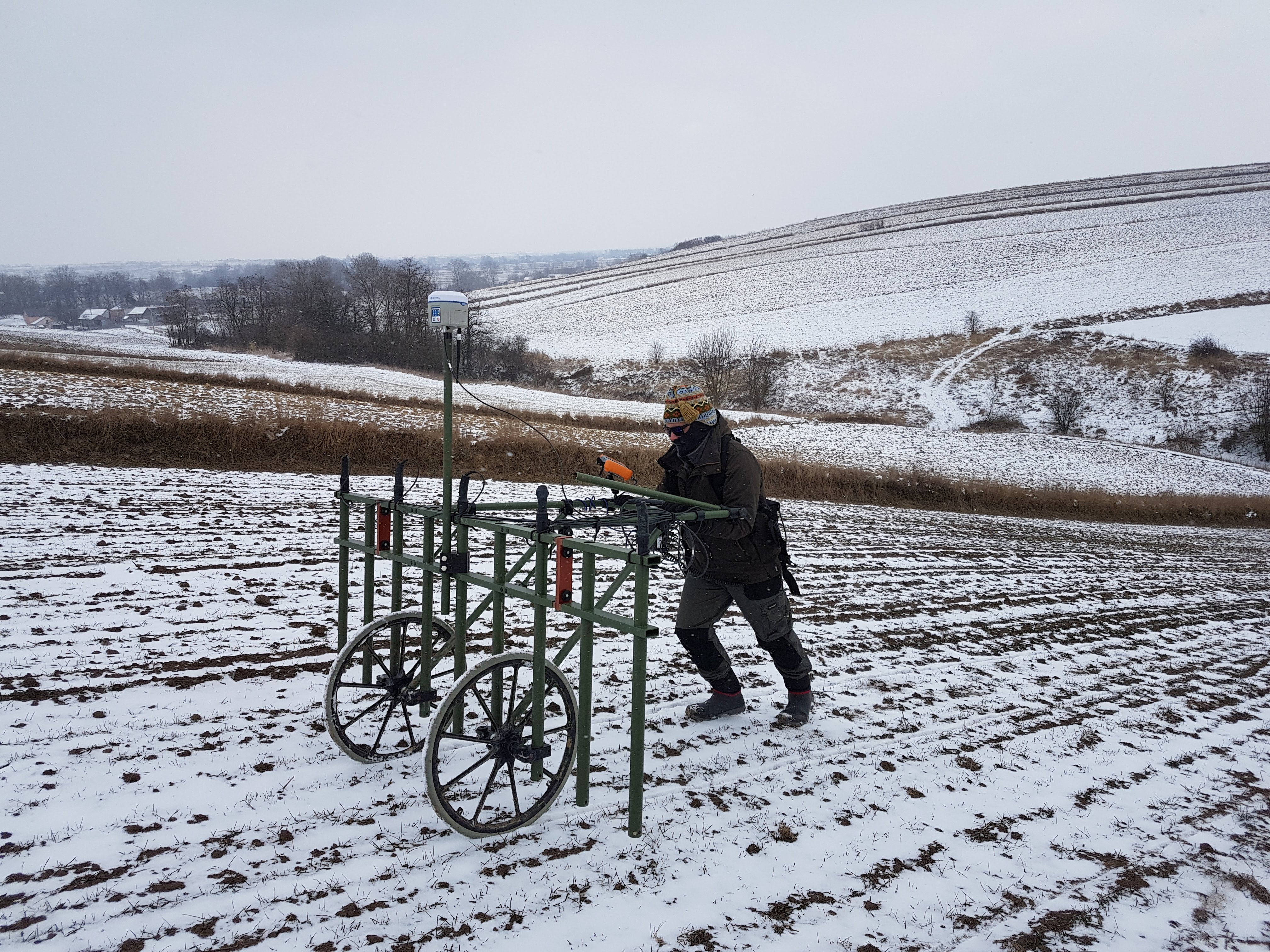
Working in difficult winter conditions at Malżyce 
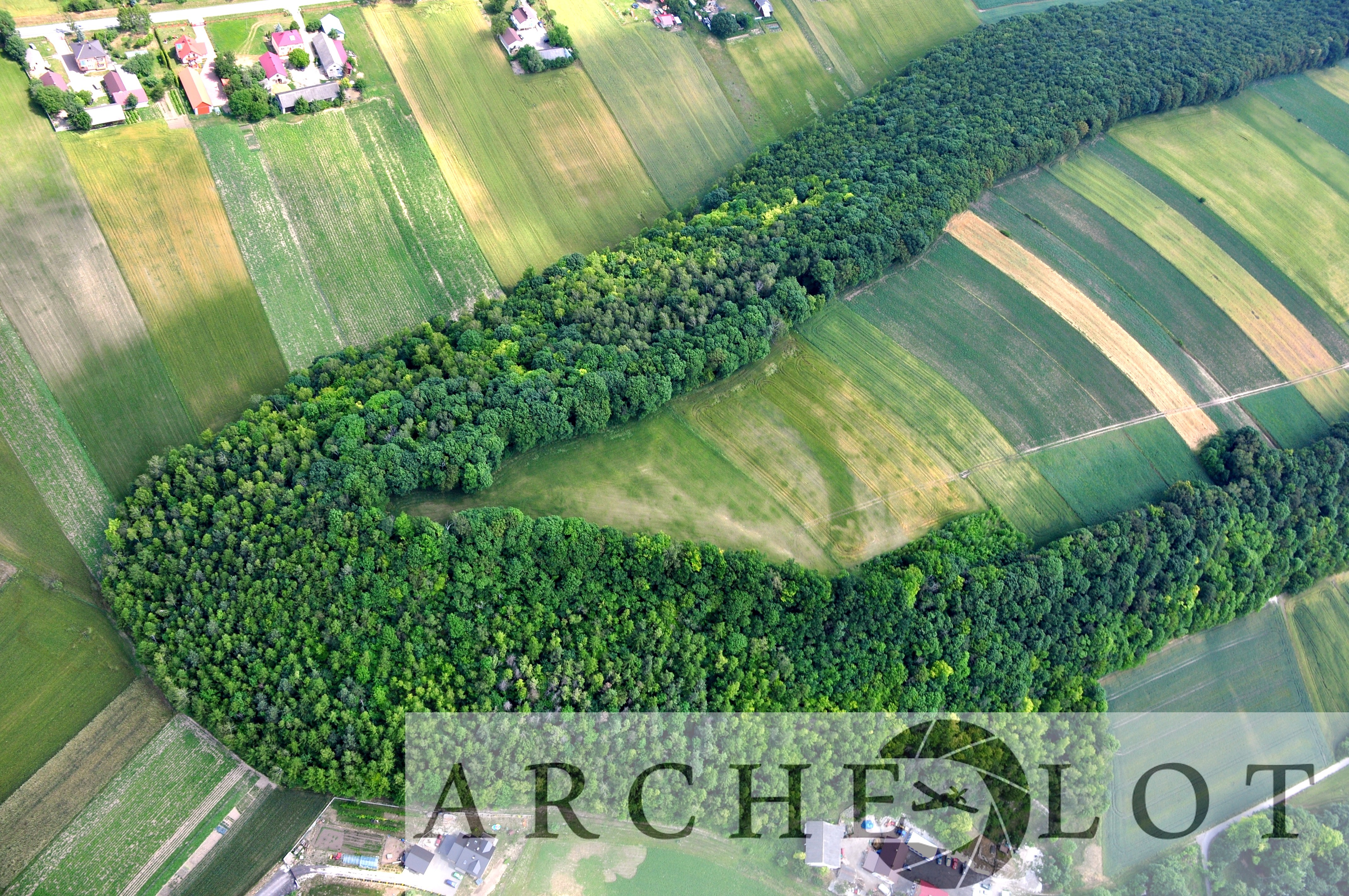
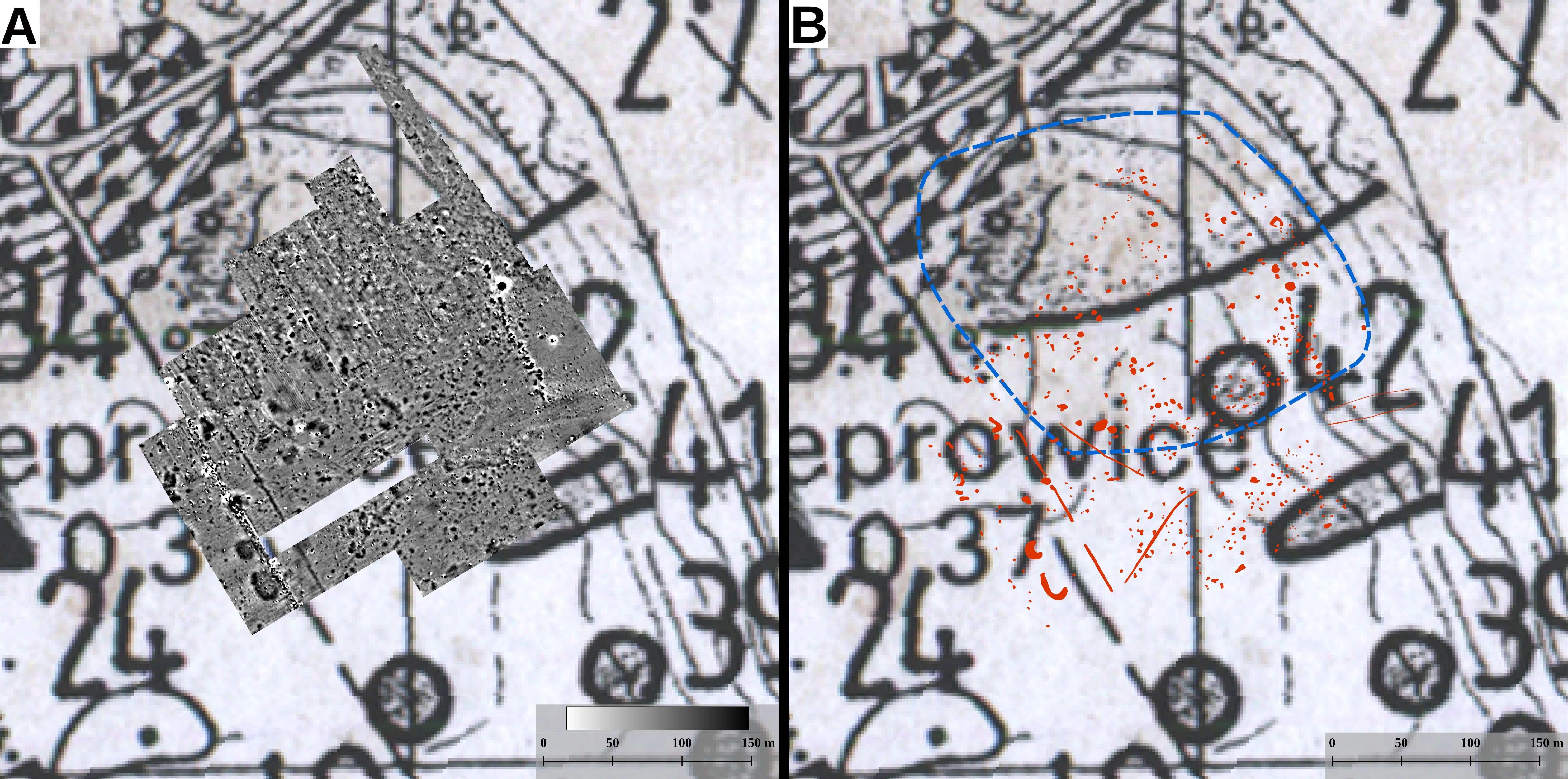
Promontory enclosure at Marchocice with crop marks revealing ditches 
The Marchocice promontory enclosure, this time with soil marks 
GPR measurements at Rzemienowice with help from abroad 
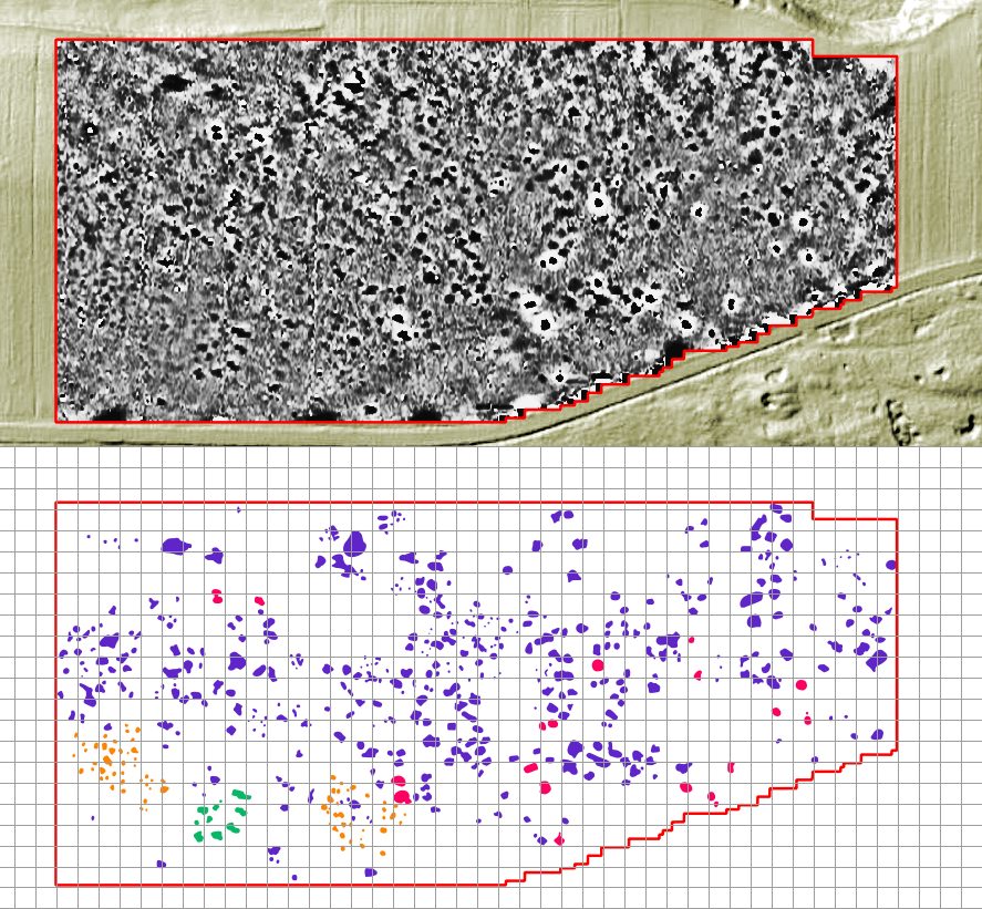
Magnetic gradiometry and interpretation at Rzemienowice 
Crop marks everywhere. It’s a good thing we didn’t listen when we were told that aerial prospection doesn’t work. 
Comparing the magnetic gradiometry data to the archaeological record. 
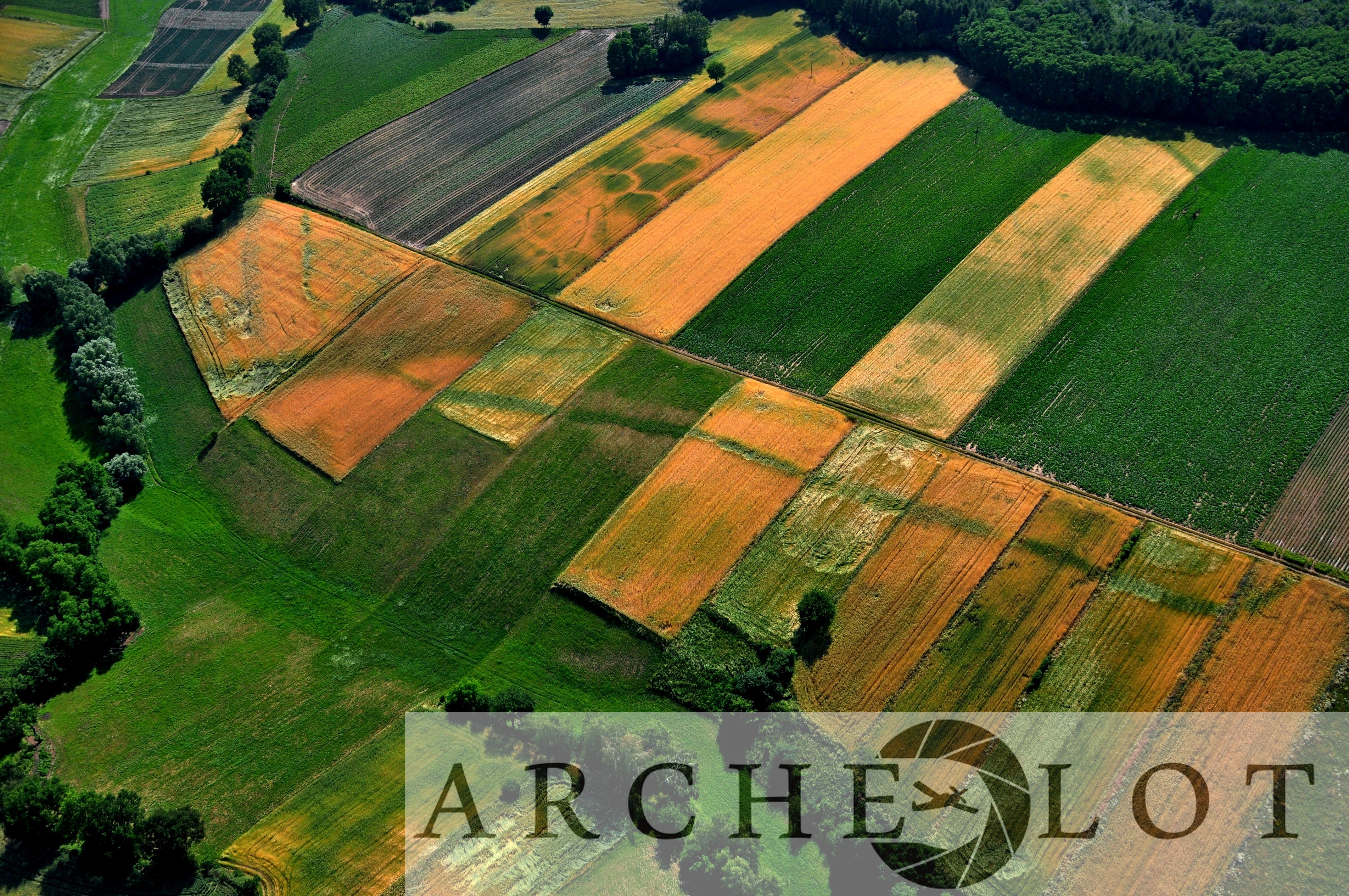
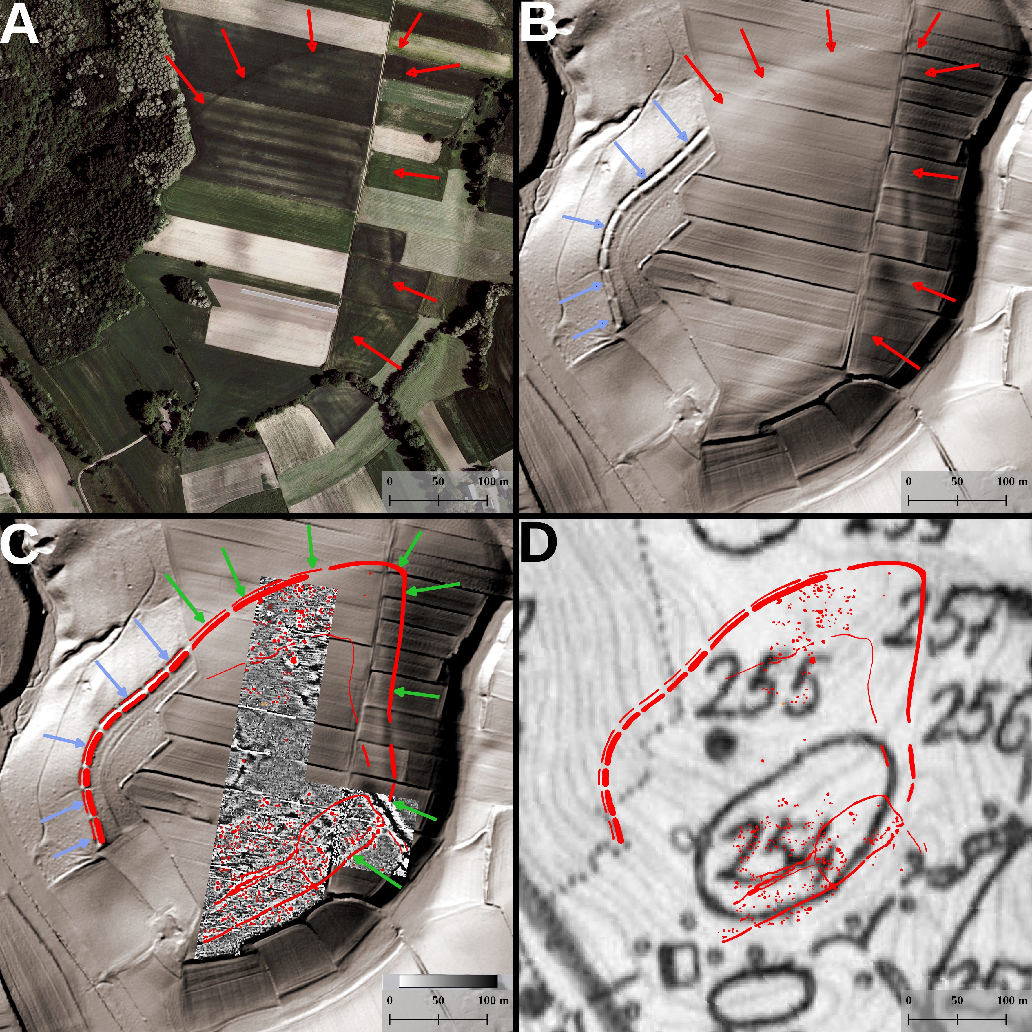
An extremeley interesting hill enclosure at Malżyce 
Malżyce as seen through ALS/LiDAR, magnetic gradiometry and comparing to the official archaeological record.


The aim of the project is to study the cultural landscapes of prehistoric communities of the Western Lesser Poland Loess Uplands through the application of non-destructive techniques. These include remote sensing, geophysics, analytical surface surveys, archival query along with Geographical Information Systems (GIS). The project will take place between 2015-2018. The study will allow to estimate the cognitive capabilities of the proposed set of prospection methods, as well as the enrichment of the existing knowledge through the discovery and revaluation of settlements and structures, whose identification was not possible through field-walking (e.g. monumental structures, such as ditched enclosures, tombs, barrows, groove objects, defensive structures, road systems, etc.), which for over 30 years has been the preferred method of settlement and landscape studies in Poland. The purpose of the project is the development of both technical and research aspects, such as:
1. Understanding the function, layout and archaeological chronology of the sites through the morphology of their geophysical and spectral signatures;
2. Estimation of the potential of various soil units for the discovery and study of archaeological resources;
3. The spatial relationship between synchronic sites;
4. Registration of temporal settlement patterns;
5. Assessment of non-destructive methods of data collection compared to traditional methods and available datasets;
6. Registration of previously unknown or unexpected archaeological source categories.
