


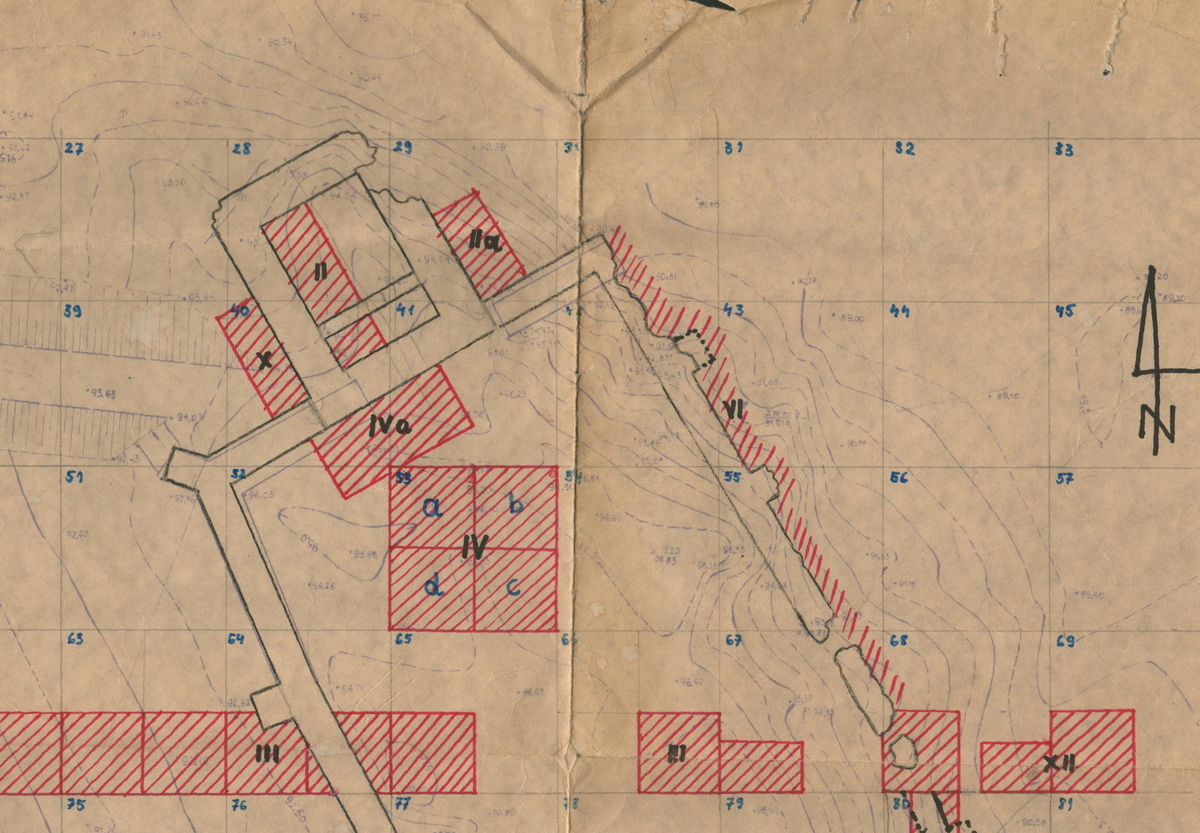
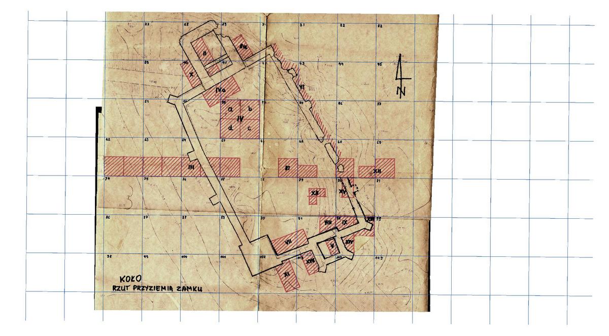
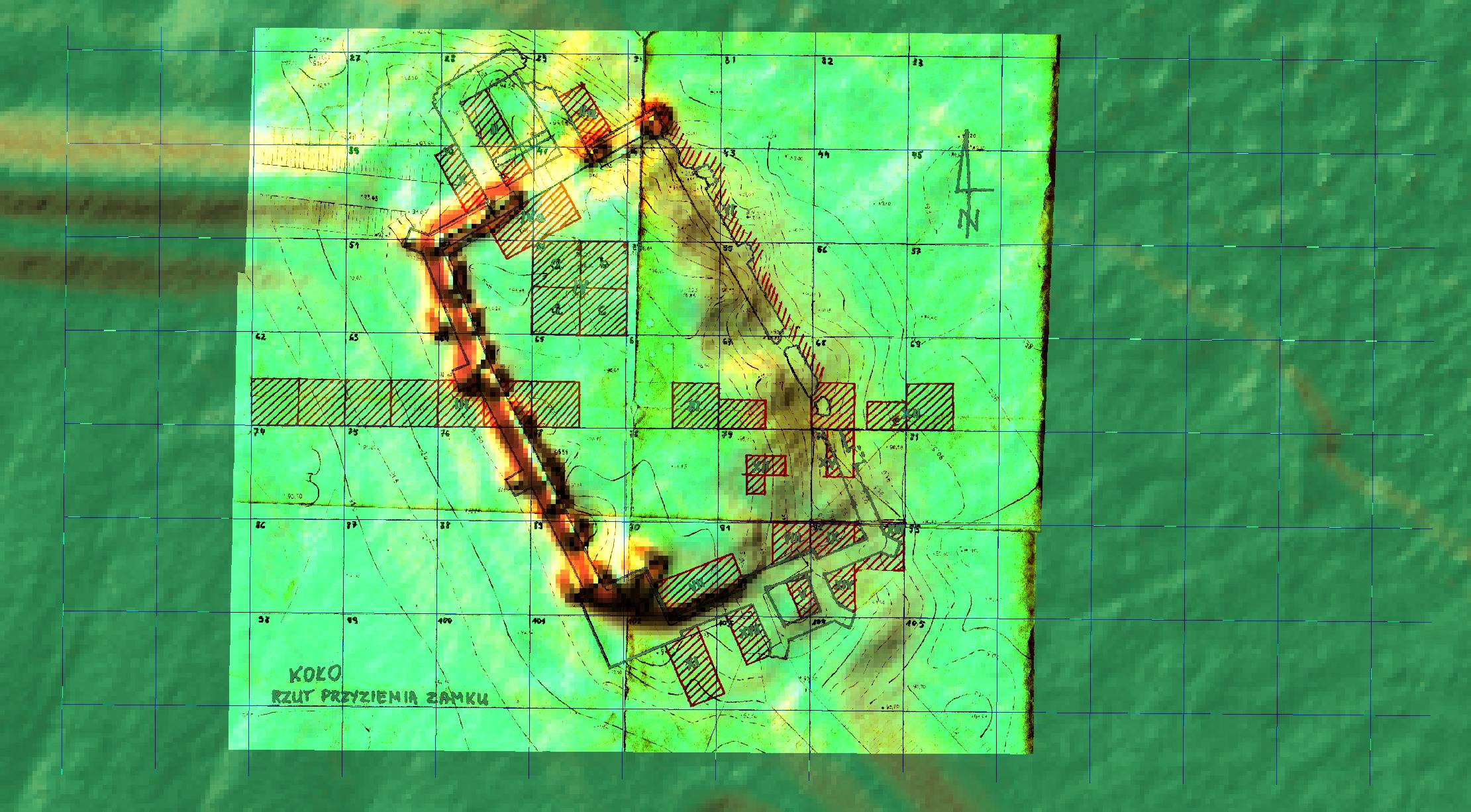
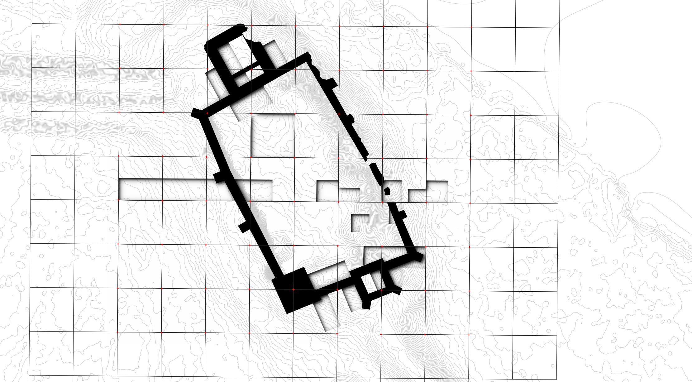
GIS augmented by ALS/LiDAR derivatives and aerial imagery can be very helpful in calibrating and georeferencing archival paper documentation. These usually can be quite schematic and may not possess any coordinates. This leads to a common situation where older research loses much of its value due to the fact that it cannot be precisely or even approximately located in a geographical space. In Koło we were tasked to carry out a GIS based assesment of the available paper excavation plans, digitise them and attempt to georeference them. The results were quite satisfactory and the Royal Castle in Koło now posses a fully digital and geographically accurate site plan.