
Early this year we were contracted by Glesum to carry out a multi-disciplinary assessment of a crucial, national-level strategic investment linked with the energy sector. Together we conducted a series…
Prospection & Digitalisation
Early this year we were contracted by Glesum to carry out a multi-disciplinary assessment of a crucial, national-level strategic investment linked with the energy sector. Together we conducted a series…
Our co-authored with the University of Wrocław grant application to the Ministry of Culture & National Heritage was accepted and in 2018 and 2019 we were able to conduct and…

The Podlaskie Museum in Białystok commissioned a GPR survey as part of their research project in Tykocin. Our aim was to attempt to map out the spatial layout of the…

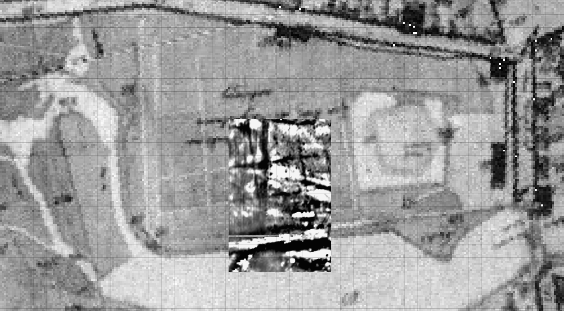
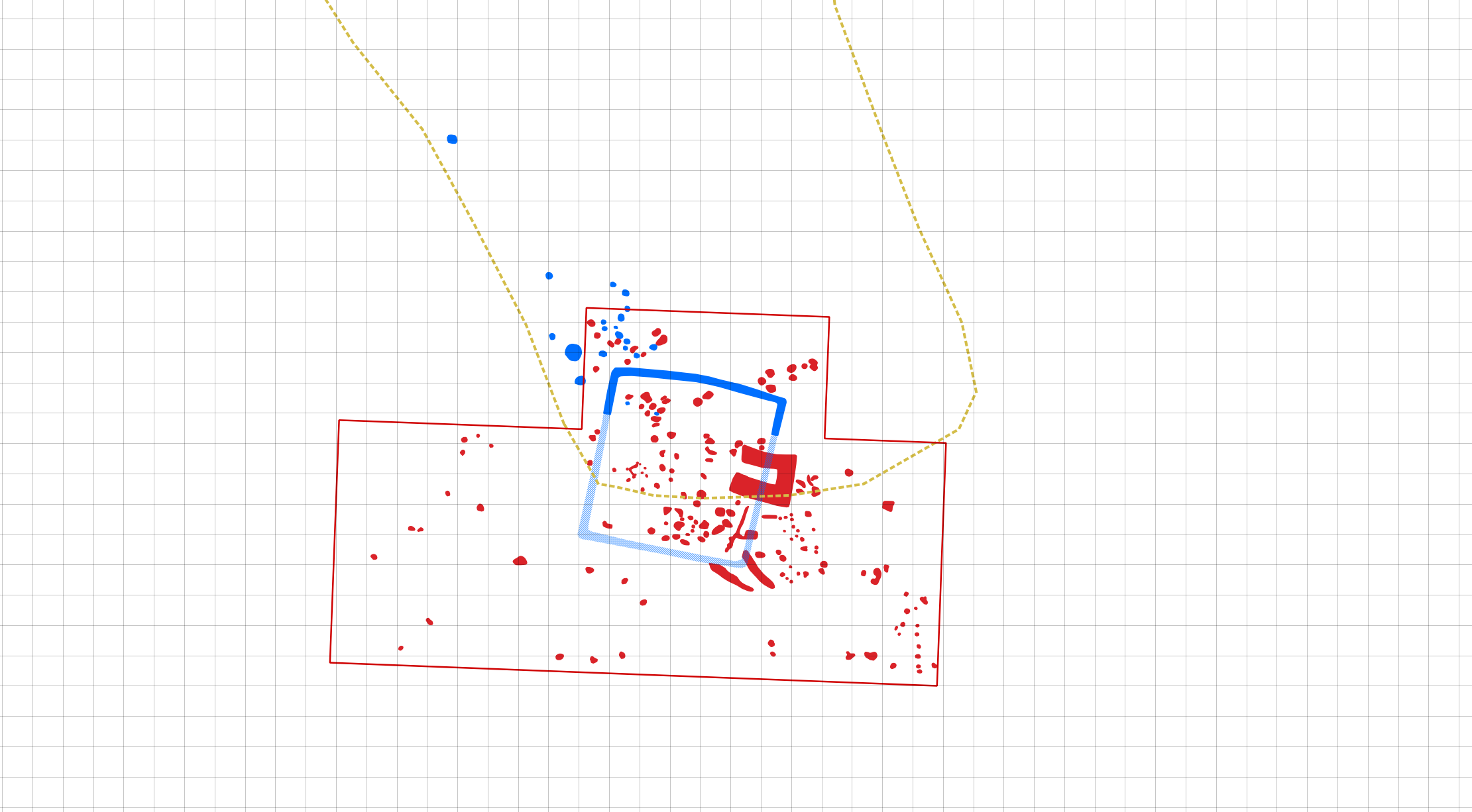
GIS augmented by ALS/LiDAR derivatives and aerial imagery can be very helpful in calibrating and georeferencing archival paper documentation. These usually can be quite schematic and may not possess any…

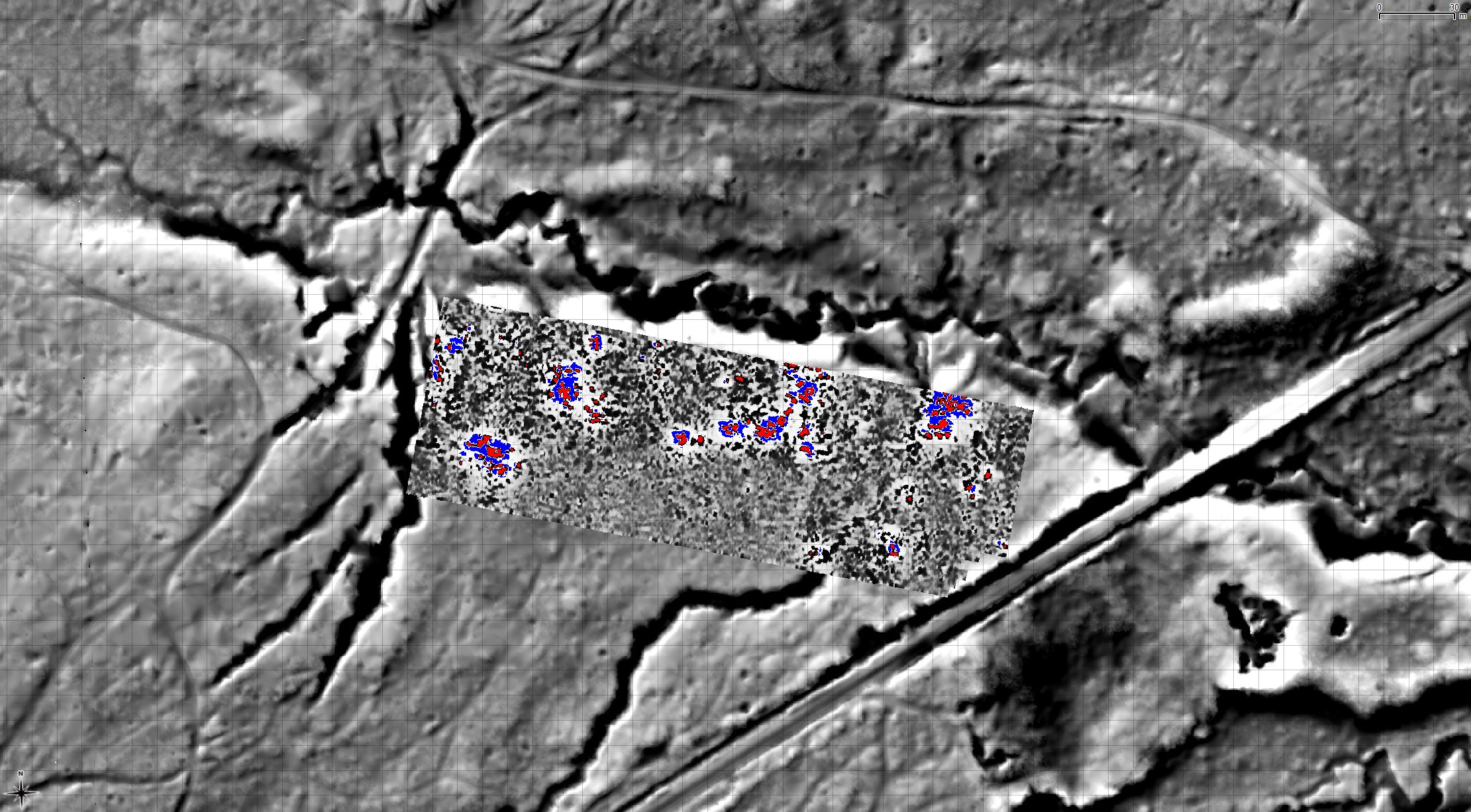
The aim of the project is to study the cultural landscapes of prehistoric communities of the Western Lesser Poland Loess Uplands through the application of non-destructive techniques. These include remote…

Dzwonowo. Średniowieczne zaginione miasto, Tom I, Środowisko naturalne, zarys dziejów, badania nieinwazyjne , M. Krzepkowski, M. Moeglich, P. Wroniecki (red.) / Dzwonowo. An Abandoned Medieval Town, Volume I, edited by…

2016-2017 marked our participation in the Ministry of Culture & National Heritage funded non-invasive research of the abandoned Medieval town of Dzwonowo project. We were responsible for geophysical (GPR, ER,…

New Nieszawa was a thriving medieval urban organism, covering approx. 22 hectares on the restless border between The Kingdom of Poland and the Teutonic Order. It was a place were…
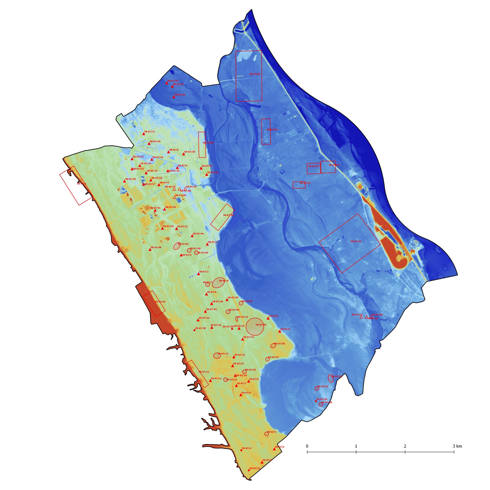
The once pioneering Polish Archaeological Record of Poland (AZP) that began in the 1970’s is still mostly undigitalised. Using and updating this database through printed files and sheets is becoming…
The survey was commissioned by the Regional Heritage Office in Piotrków Trybunalski in order to locate the remains of the Bishop’s Castle in Wolbórz. Two methods were applied including magnetometry…
In 2015 we participated in a Ministry of Culture and National Heritage project led by prof. Szymon Orzechowski that included field-walking, geophysics, ALS data processing and creating a GIS database…
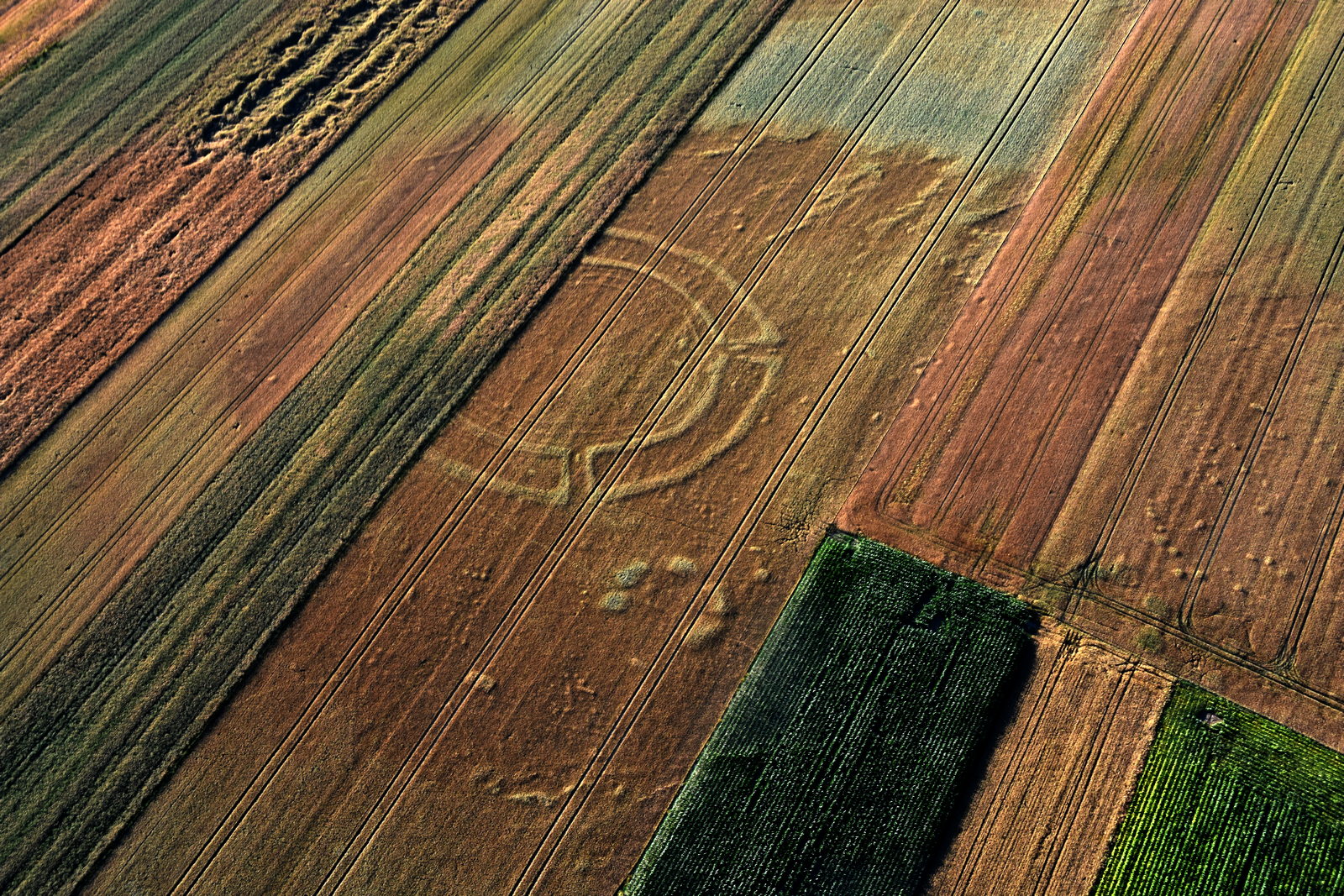
As part of our on-going aerial prospection collaboration with the University of Wrocław we documented an interesting quadrate enclosure. This research shows a simple yet enganging example of data complementarity…